Overland

The Daisy Pass Expedition

Topping out at 12,807 ft at the top of Granite Peak and as home to the roughly 40 highest peaks in the state, the Beartooth Mountains are the undisputed roof of Montana.  The towering peaks are composed primarily of Precambrian granite and metamorphic rocks dated to approximately 2.7 to 4 billion years old, making them among the old rocks on earth.  The Beartooth range sits astride the Montana and Wyoming border to the North and East of Yellowstone National Park.  The Beartooths make up the eastern half of the 900,000 acre Absaroka-Beartooth Wilderness and are largely devoid of roads other than a few dirt access roads winding into the larger canyons. The notable exception is the Beartooth Highway. US route 212 climbs gradually from the Northeast entrance of Yellowstone Park to the 10,947 ft top of Beartooth Pass before plunging precipitously into Red Lodge, Montana.

Carl, Ashley and I had been talking about venturing into the Beartooth Mountains all summer. I had driven the highway many times but had explored little of the canyons around Cooke City and Red Lodge, and neither of my two companions had even driven the highway.  A first attempt at the trip  fell prey to time constraints, lack of planning, and serious lack of commitment issues, but this time it was on.  Carl was going down in the morning to hike with a friend in Yellowstone, but since Ashley had to finish up some work and I wouldn't be able to take Lex out hiking in the Park, the two of us would meet Carl at Roosevelt Lodge in the evening.

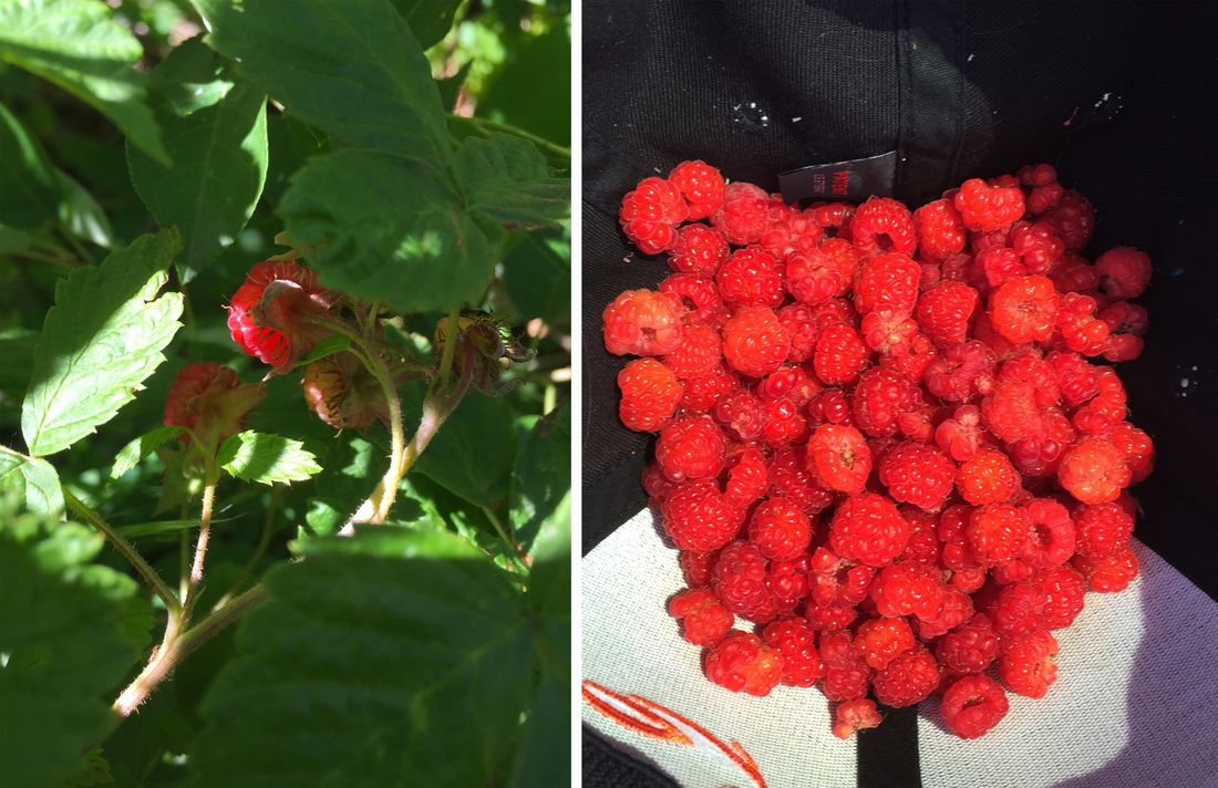
I met Ashley a little after noon and we loaded up the truck and headed east on the freeway.  We had decided that a quick stretch of the legs was in order before we started the drive down to the park, so we took the Trail Creek exit and released the hound onto the trail of Chestnut Mountain.  We enjoyed a nice relaxing hike up the mountain, soaking in the summer afternoon and the perfect weather before deciding it was time to hit the road.  However, before we could reach the truck, our plans were derailed by the discovery of wild raspberries.  Ashley spotted the first few berries peeking out of leaves right along the downhill side of the trail, and before we knew it we had worked our way into a massive thicket of the juicy red berries.  While we had started popping them in our mouths as quickly as we picked them,  it soon became apparent that the amount of berries we were encountering necessitated a more dedicated collection effort.  About an hour after the discovery we were finally climbing back into the truck, fresh raspberries in the cooler, and working our way south towards Gardner.  I had been expecting the worst at the Yellowstone entrance station, but we were pleasantly surprised by the lack of a line and we were soon cruising past the elk at Mammoth Village and rolling out of the hills into Tower Junction and Roosevelt Lodge.  We found Carl enjoying a cold beverage on the lodge's front porch and joined him for some relaxation in the rocking chairs before heading into the lodge to rustle up some grub.

BT_1.jpg
BT_2.jpg

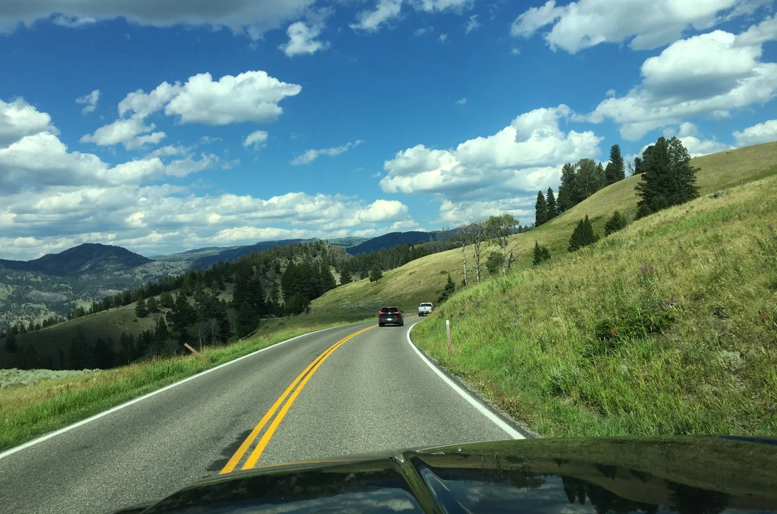
After filling up with burgers, fries, and tamales, we climbed back into the cars and hit the road to Cooke City.  It was a perfect summer evening and we were joined by a coyote family and the usual herds of buffalo as we enjoyed the scenery of the Lamar Valley.  Leaving the wildlife and tourists of Yellowstone in the rear view mirror, we passed through the quaint but touristy main streets of Silver Gate and Cooke City before finally reaching the Lulu Pass road, our planned camping area for the next couple nights.  Good camp sites were at a premium but we soon found a nice secluded spot behind the creek and set up camp for the night.  The fire ring was in a serious state of disrepair, but even the moderate swarm of mosquitoes and a light rain shower couldn't dampen our efforts and the fire ring was soon repaired and filled with a roaring camp fire.  S'mores and Smookies (a s'more with cookies instead of gram crackers, of course) were produced, and we finally crawled into the sleeping bags, ready for a good nights sleep and the coming day of adventure.

BT_3.jpg
BT_4.jpg

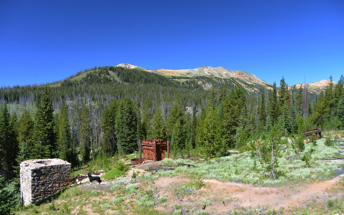
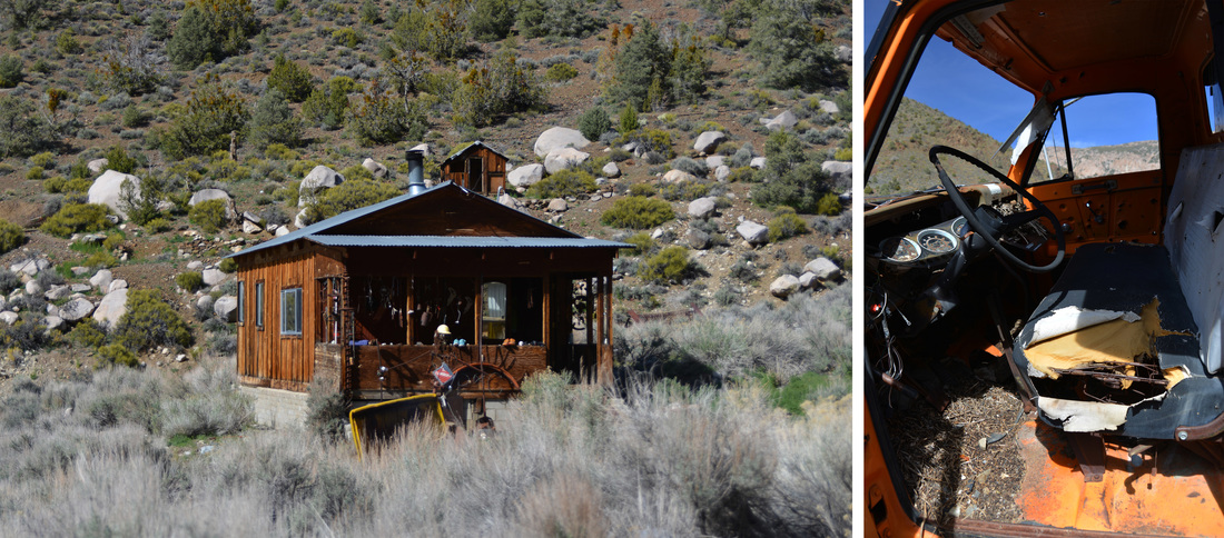
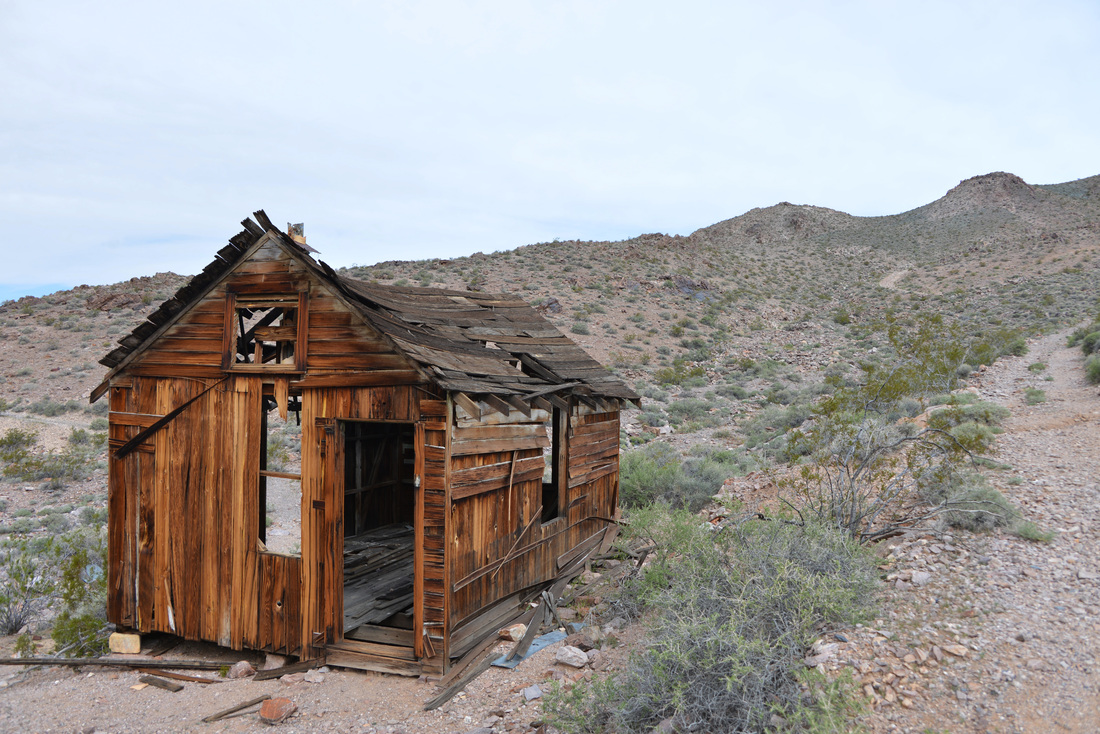
After a good night's sleep, we awoke to sunny skies and gorgeous scenery.  The cool mountain air was invigorating as we ate breakfast and pilled into the Raven, leaving Carl's car to guard our campsite.  The first stop of the day was an old mining area just up the Lulu Pass road that I had found while conducting some Google Earth surveillance.  We pulled off into a spur road and parked the truck at the remnants of an old building.  The towering bones of a stone fireplace and chimney stood watch over the skeletal remains of the old foundation and cellar.  While only a few ruins remained, it was clear that this had been a grand building in its day.  We poked through the rubble and explored the nearby twisted remains of metal track before working our way further down the dirt trail.  Reaching the end of the road, we found ourselves at a small trail head surrounded by derelict mining equipment, ramshackle cabins, and bullet hole riddled cars and machinery.  Two old cabins and discarded mining equipment in various states of disrepair were explored before walking down the hill into what had obviously been the main processing and milling area.  Rusted shells of equipment lay at rakish angles amongst the stone foundations of furnaces and buildings.  A massive hamper of some sort stuck out proudly from the discarded pipes, gears, and other forgotten machinery.  A large flattened bench dotted with footings appeared to outline the extent of one of the processing facilities.  Wondering about the people that built these workings and mined the hillsides, we clambered over the stone benches and explored the old wreckage while Lex performed the obligatory sniff test on all the pertinent objects under investigation.

After satiating some of our curiosity, we hiked back to the road, loaded into the truck, and set out for Lulu Pass.  The road wound its way higher into the mountains past more relics of the bygone mining days and the run down cabins of the men who called these places home.  The road deteriorated as we climbed towards the pass, but the Raven was easily up to the task and only a couple of exploratory stops delayed our arrival on Lulu Pass.  We soaked in the stunning views from the pass; the craggy summits of Pilot and Index peaks sticking out from the ridge line to the south and the towering hulks of the high points around Montana's tallest peak, Granite Peak, to the east, all bathed in the mid day sun.  Such a breathtaking vista called for extended enjoyment, so we settled into a pullout on the flanks of Fisher Peaks and dived into sandwiches and snacks on the tailgate.

"Hey, its a beautiful morning, why aren't you getting up yet?"

"Hey, its a beautiful morning, why aren't you getting up yet?"

BT_7.png
BT_15.png
BT_16.jpg
BT_19.jpg
BT_22.jpg
BT_23.jpg
BT_25.jpg
BT_32.jpg
BT_36.jpg

With the remains of our lunches stowed back into the coolers, we set off for a little walk up to the top of Fisher Mountain.  Fisher Mountain tops out at 10,260 ft, but is only a short hike from our lunch spot at the top of Lulu Pass. We clambered up through a steep, lush meadow of alpine wildflowers before reaching a rough 4-wheeler track coming up from the other side of the peak and crested the top of the mountain.  Lex seemed to enjoy the breathtaking views just as much as the rest of us, and we took a few minutes to relax and enjoy the scenery. However, we had more terrain to explore, so we reluctantly left the top of Fisher Mountain, worked our way back to the Raven, and started to work our way around the backside of Fisher Mountain and into the old mine on the south west side of the peak.

The Daisy Pass area is part of the New World Mining District. Historic activity in this district included gold, silver, lea, zinc, and copper mining.  Several hard rock mines were developed on Henderson Mountain in the late 1870's, but they were not extensively worked until the late 1880's.  Much of the mining activity in the district was centered on Republic Mountain, South of Cooke City, and Miller Mountain, North of Cooke City.  The first recorded discovery in the district was by four prospectors and trappers on upper Soda Butte Creek in 1869.  However, their horses were run off by Indians and their expedition was cut short.  Several mines were discovered and staked in a return expedition in 1874, and claims on both Republic and Miller Mountains were established the following summer.  Steady mining development of the district began in 1882.  The Homestake Claim was filed by Sam Mathers on the slope of Henderson Mountain and by 1887 it had produced enough gold and ore to ship to Salt Lake City for processing.  The Homestake claim proved to be rich and was mined extensively until 1894.  The Montana Mining Company acquired nearly one hundred claims Northeast of Cooke City in the early 1900's including properties on Henderson Mountain and Scotch Bonnet Mountain which lie on either side of Fisher Mountain.  By the winter of 1921, six companies were at work in the district and were producing enough ore to raise the possibility of a railroad to Cooke City.  However, the railroad never materialized, and the mines began to shut down in the mid 1920's.

The New World mining district produced 65,000 ounces of gold, approximately 500,000 ounces of silver, and about 4,100 short tons of copper, zinc, and lead between 1900 and 1955. While remote and isolated, the region was the third largest producer of precious metals in Montana in 1926.  In the end, the district was doomed by the lack of and expense of transportation and the harsh winters.  We spent some time wandering a couple of the old mining roads and new trail heads while taking in the mountain scenery.  Scars of the bygone mining era were plainly visible all around us, and we pondered over the history that these mountainsides must have witnessed while we worked our way back to the main road and Daisy Pass.  Upon cresting the summit we parked the truck and explored the pass on foot.  Though it was late into the summer, a snow bank lingered on the east flank of the pass above the truck.  The opportunity was to good to pass up, and Lex, Carl and I were soon found ourselves glissading down the snow field.

BT_50.jpg

Leaving Daisy Pass in the rear view mirror we started the descent down the South side of the pass back into the valley and Cooke City.  Numerous side roads leading off into the unknown tantalized us, but the day was running short and exploration of these tracks would have to wait till another day.  We stuck to dirt back roads and avoided the highway all the way back to the Lulu pass road and were soon climbing back towards camp.  However, we just couldn't make ourselves call it a day quite yet, so we set off for a little more exploration and turned off on a rough side road climbing up the Southeast side of Henderson Mountain.  The road treated us to more breathtaking views of Pilot and Index peaks as it switchbacked up the side of the mountain.  Knowing the road didn't go much further, we parked the truck in a high meadow below Henderson Mountain and set off on foot up a four wheeler trail that climbed towards the ridge line.  After soaking in the afternoon sun and checking out a rescue gear cash, we worked our way back to the truck and returned to camp.  We soon had the campfire crackling back to life and proceeded to whip up some steak sandwiches and potatoes and peppers cooked in foil over the coals for dinner.  Sunset turned to starlight as we relaxed around the campfire before finally crawling into the sleeping bags to rest up for one more day of adventure.

BT_66.jpg
BT_73.jpg

Monday morning dawned crisp and clear, perfect weather to head higher into the mountains towards the top of the Beartooth Pass.  After fueling up for the day with breakfast, we packed up the cars and worked our way back down the Lulu Pass road to the highway were we turned the trucks east.  The highway slowly wound its way through forests, wet meadows, waterfalls, and lakes as it gradually climbed higher into the alpine.  Soon the signs for the Clay Butte fire lookout appeared on the side of the road.  On a whim, we followed their directions and turned off the highway back onto a dirt side road.  Unfortunately it turned out that the road and fire lookout were closed on Mondays, so we parked the truck at the closed gate and set out towards the lookout on foot.

The Clay Butte Lookout was completed by the Forest Service in 1943 and is listed on the National Register of Historic Places.  From its windows the rangers had a stunning 270+ degree view across the valleys of Montana and Wyoming stretching out into the distance.  It is a life that has always intrigued me, and the thought of spending a summer scanning the horizon for signs of fires from your own lookout is always fascinating.  We spent some time taking in the views and as much of the lookout tower as we could access before heading back to the cars and resuming our journey up the highway.  Not long after leaving the lookout we passed Beartooth lake, Top of the World Lodge, Island Lake, and started to work our way into true alpine landscapes.  The switchbacks in the road became tighter and more frequent the higher we climbed, and before long we were nearing the pass.  We stopped in a pullout along one of the upper switchbacks and set off on foot up into the alpine tundra.  More stunning scenery was the reward for our efforts, and we spent some time enjoying the views while Lex played in the snowbanks before heading back to the cars and up to the Beartooth Pass.

The Beartooth Pass parking area was filled with tourists enjoying the views, but we easily found a place to park and a nice soft piece of tundra to relax on over lunch.  We lounged back into the soft hummocks of vegetation as we enjoyed the afternoon sun and our sandwiches.  All too soon it was time to keep moving, so we reluctantly packed up the truck and hit the road again.  Finally reaching Red Lodge, we celebrated the completion of the trip with some refreshing Ice Cream along the Main Street of town before parting ways and heading for home.  It was a great trip filled with amazing scenery, weather, and company.  It was wonderful to explore some of the areas that I have driven by for so many years, and the trip whetted our appetite for further adventure in the Beartooths!

BT_98.jpg

A Death Valley Spring Part 4 - Panamint City

Miss the first part of the adventure?  Check out the first three blog posts below:
A Death Valley Spring Part 1 - Echo Canyon
A Death Valley Spring Part 2 - Troubles in Titus
A Death Valley Spring Part 3 - The Racetrack

Day 7

Friday, our last day of adventure before we had to pack up shop and embark on the long drive back to Montana.  The impending end of the trip was uncomfortable to swallow, but the anticipation of the hike ahead quickly pushed those thoughts out of our heads as we turned south down Panamint Valley towards Surprise Canyon.  This was the first hike that I had found during my research of the area and the descriptions of the uncommonly lush creek bottom and waterfalls had captured our imagination and had placed this day on the top of our to-do list.  The hike to Panamint City through Surprise Canyon starts outside of the park in the BLM's Surprise Canyon Wilderness Area and only the remains of the city and about a third of the hike reside within the boundaries of Death Valley National park.  Somewhat strangely, there was no mention of the hike in our guide book, and all we had been able to glean of the trek were conflicting distance estimates and foreboding descriptions of the difficulty of this expedition.

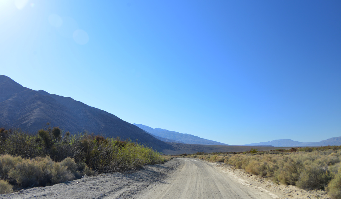
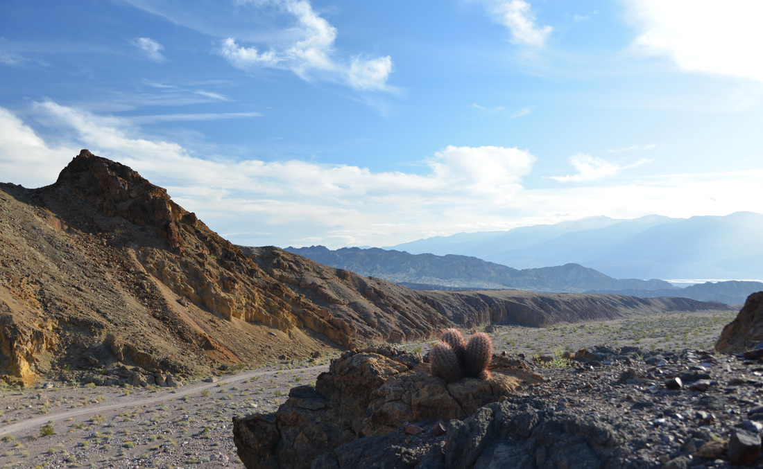
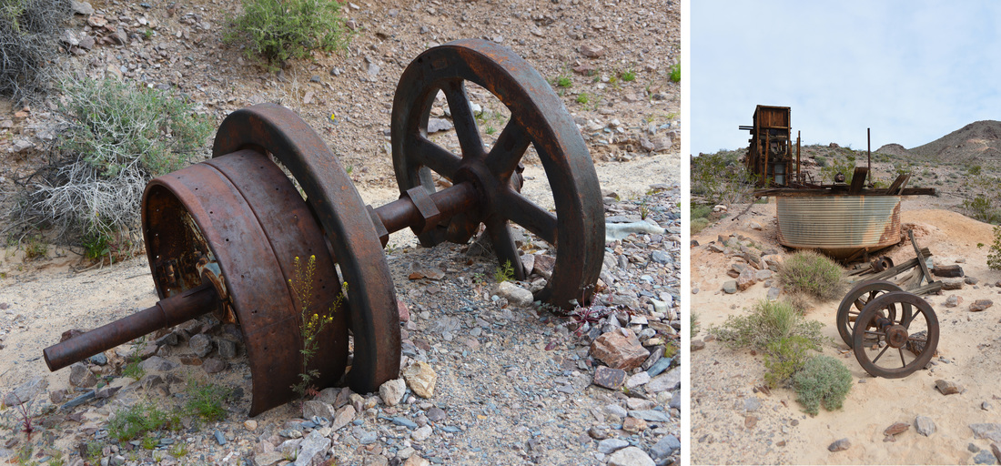
The dirt back road took us along the base of the Panamint Mountains through scrubby desert foothills and around barren traces of ponds as Naval fighter planes cavorted above us.  The road up the lower reaches of Surprise Canyon was a pleasant drive and we were soon pulling into the parking lot next to the ruins of the Chris Wicht Camp.  This was once a mining camp and mill site but it burned down in the recent past, leaving behind only the concrete and rock skeletons of structures and discarded mining equipment.  We took a few minutes to wander the ruins and explore the old buildings and rock walls before gearing up for the hike.  After loading the day's rations into our packs and lacing up our hiking boots, we set out up the wash into the unknown of Surprise Canyon.

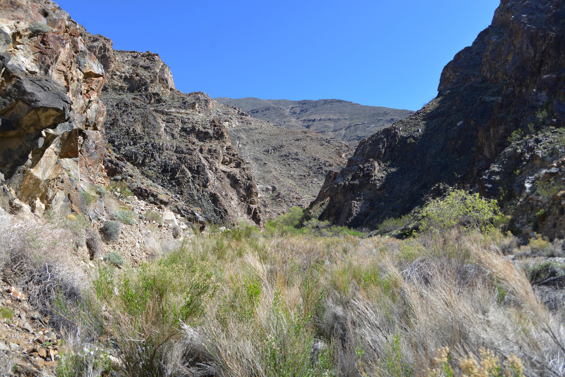
Following the obvious hikers trail from the parking lot we were immediately introduced to the unusual lushness of Surprise Canyon.  Passing through surprisingly dense and vibrant vegetation around the running stream, we climbed through the remnants of an old mill and started bushwhacking up through the wash.  There is a semblance of a hikers trail that is occasionally trimmed to make walking easier, but we quickly found ourselves stooping and pushing through the brush as we followed the rough trail.  Old equipment and trucks are scattered up the canyon, likely washed down by the flash floods that ended mining at Panamint City in the 1980s, and route finding is made substantially more difficult by false paths that lead through twisted thickets or dead end all together.  Despite these challenges we made good time and soon found ourselves climbing over the waterfalls and cascades that the lower canyon is known for.  We had heard that the easiest path here is through the waterfalls, but we found the going fairly easy along the sides and only a few small stretches necessitated mild scrambling over the slick rock to bypass the falls, none of which was anything close to the difficulty of the scrambling we had done in Slit Canyon a few days prior.  Amazingly, after the road through the lower canyon was washed out by flash floods it remained open to vehicular traffic for several years, with adventurous off road drivers winching their jeeps over the falls and up the canyon.  Thankfully the "road" was closed in 2001 and the riparian area has regenerated and is now one of the most unique areas around Death Valley.

DV4-1.jpg
DV4-2.jpg
DV4-3.jpg
DV4-4.jpg
DV4-5.jpg
DV4-6.jpg
DV4-7.jpg
DV4-8.jpg
DV4-9.jpg
DV4-10.jpg
DV4-11.jpg
DV4-12.jpg
DV4-13.jpg
DV4-14.jpg
DV4-15.jpg
DV4-16.jpg
DV4-17.jpg
DV4-18.jpg
DV4-19.jpg
DV4-20.jpg
DV4-22.jpg

After emerging from the falls unexpectedly dry, we followed the "trail" back into a winding path of thickets, brush and horsetail with numerous possible route choices, not all of which proved to be the easiest alternative.  After working our way up canyon for a couple hours the thick riparian vegetation began to give way to a scrubby desert canyon ecosystem.  Here the trail began to work its way around the thicker brush along the sides of the canyon, and after several scrambles along the canyon wall and one minor incident involving a hand hold Ashley tried to use that was already occupied by an unaccommodating cactus, we were starting to think about lunch and wondering how far we had to go.  Not having any good idea what to expect through the canyon, we made a guess of our location on the map and decided to continue on to see if we were as close to the city as we thought.

We were not.  Not even close.  After entering a second stretch of thick vegetation and walking through the running creek we realized we had just passed through Brewery Spring.  With a good handle on our position and the knowledge of how far we had yet to go, we took a break in the shade of the towering canyon walls and dove into our sandwiches.  Refreshed from a nice lunch break, we continued on up the canyon and soon found ourselves in the transitional zone between the dry desert canyon and high desert juniper forests.  The trail had begun to follow the remnants of the old road by this point and walking was much easier, although the exposure and lack of shade were increasing the discomfort of the hike.  We began to pass parts of a backpacking group heading to the cabins of Panamint City, each of whom inquired if we had passed a certain member of their party with a cowboy hat.  Informing them that we had seen this individual struggling up the canyon, we learned that they thought he might have turned back by then, and that his pack was heavy due to his load of "cigarettes and energy drinks."

Although we had not encountered the seemingly vertical grades and blistering heat warned about in some write-ups on the hike, the terrain and sun of the upper canyon were beginning to take their toll.  It was with relief that the smokestack of the mill at Panamint City was pointed out to us as we passed the lead group of backpackers, and with a landmark to shoot for we soon entered the ruins of the upper end of Panamint City and found a place to rest in the shade of the old mill building.  Grateful to have finally reached our destination, we relieved ourselves of our packs, had a snack, and relaxed before spending some time exploring the ruins of the mines.

DV4-23.jpg
DV4-24.jpg
DV4-25.jpg
DV4-26.jpg
DV4-27.jpg
DV4-28.jpg
DV4-29.jpg
The feisty, unaccommodating cactus that Ashley discovered.

The feisty, unaccommodating cactus that Ashley discovered.

DV4-31.jpg
Yep, that creek in the left picture is the "trail." Supposedly that is known as the "tunnel of love" as it passes through brewery spring (right).

Yep, that creek in the left picture is the "trail." Supposedly that is known as the "tunnel of love" as it passes through brewery spring (right).

DV4-33.jpg
DV4-34.jpg
DV4-35.jpg
If you look closely, you can see the smokestack on the right side of the canyon bottom, tantalizingly close but not getting bigger quickly...

If you look closely, you can see the smokestack on the right side of the canyon bottom, tantalizingly close but not getting bigger quickly...

DV4-37.jpg

Panamint City was founded by several bandits who discovered silver while hiding out in the area and convinced a Nevada senator to grant them amnesty in exchange for the opportunity to buy the claim.  At its peak the city had a population of over 2,000 people and a 1.5 mile long main street lined with dozens of saloons, a bank, brewery, post office, and the city's own newspaper.  Panamint City had a rough reputation and was once called the toughest, rawest, most hard-boiled little hell hole that ever passed for a civilized town.  Even Wells Fargo refused to open an express office in the town, and the founding bandits' plans to steal the ore as it left town was thwarted only by the owners' clever decision to cast the ore in "cannon balls" to big to be carried by a single horse and rider.

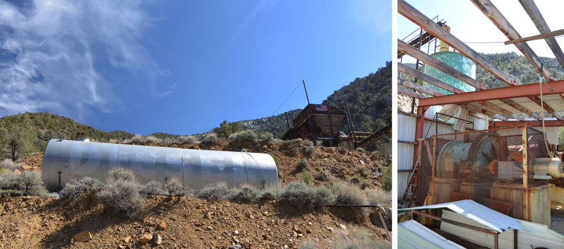
We did not explore the remaining cabins much as the backpacking party had reached the town and were setting up shop in the mouse riddled cabins that are "maintained" and used by backpackers.  Shockingly, the faucets even reportedly work in some of the cabins, although while we were there resting one backpacker found out otherwise and broadcast the news through the valley with a mighty holler...  Wanting to stay away from the noisy party, we checked out the remnants of the old mill before climbing farther up the hill to the newer processing building decaying on the hillside above the city.  This new mill dates from the late 1970s or 1980s and sports surprisingly good looking equipment and electricity.  Although the mine was not extensively worked after the flash floods in 1983, some of the equipment looked operational and in amazing condition.  The sheet metal of the building was falling apart, but much of the equipment appeared dirty but functional.  Rubber belts without any obvious major decay were looped on the equipment, modern water valves poked out from the pipes, an American flag free of tatters was attached to the ore bin, the PVC pipes sported an impressively new looking coat of white paint, and some of the equipment and the ore bin still contained unprocessed ore.  These were by far the eeriest ruins we explored on the trip, the modern machinery combined with the bright paint and new fixtures made the place look like it could have been abandoned the week before.  Rather someone has done a little work on the mine recently or not, it certainly appears that it is a possibility, making the place feel only semi-abandoned.  I can only imagine what the ruins of a modern disaster such as Chernobyl must feel like, but this mine gave a good taste of what it feels like to be in a place where lives were dropped at a moments notice.

DV4-38.jpg
DV4-39.jpg
DV4-40.jpg
DV4-41.jpg
DV4-42.jpg
DV4-43.jpg
DV4-44.jpg
DV4-45.jpg
DV4-47.jpg
DV4-48.jpg
DV4-49.jpg
DV4-50.jpg
DV4-51.jpg
DV4-52.jpg
DV4-53.jpg
DV4-54.jpg
DV4-57.jpg
DV4-59.jpg
DV4-60.jpg
DV4-61.jpg

With eerie feelings still lingering, we set off back down the canyon as the afternoon wore on towards evening.  The hike down Surprise Canyon was pleasant and much quicker than our trek up to the ruins.  After working our way though the thickets of Brewery Spring and Limekiln Spring we descended the water falls we had climbed in the morning and returned to the bottom of the canyon.  After a few detours on deceptively good looking trails that took us to dead ends, we returned to the Chris Wicht camp and soon were pulling the lawn chairs out of the truck to relax in the shade as the late afternoon sun crept ever closer to the ridge tops.  After freeing our feet from the hiking boots and enjoying a refreshing face wash, we returned to Panamint Springs where we enjoyed a well deserved pizza on the porch before returning to Lake Hill Road to make our last camp in Death Valley.  Without a doubt, Surprise Canyon lived up to our expectations and was maybe the most exciting hike of the trip.  It is certainly a strenuous hike, especially if done in a single day as we did, but it did not live up to the warnings of a living hell that I had read online.  Maybe it is my experience climbing mountains, but I found the roughly 11 mile hike to be quite doable and even enjoyable as a day excursion.  That being said, we were the only group we saw that day who accomplished the trip as a day hike, so that may be saying something...

DV4-64.jpg
DV4-67.jpg
DV4-68.jpg
DV4-69.jpg
DV4-70.jpg
DV4-72.jpg
DV4-74.jpg
DV4-75.jpg
DV4-78.jpg
DV4-79.jpg
DV4-81.jpg
DV4-82.jpg
DV4-83.jpg
DV4-84.jpg

Day 8

The return drive.  Those three words that we had been avoiding the last few days were now no longer avoidable.  Although we joked about setting up shop in an old mining cabin somewhere, we knew we must start the long journey back towards Montana and "real life."  However, we were not beyond some final procrastination, so we set out to squeeze some last adventure into the morning before hitting the road.  Our first stop after a breakfast of delicious pancakes was Darwin Falls.  This is one of the most popular walks around Panamint Springs due to its short length and the allure of a waterfall at the end, a definite rarity in this desert.  After finding a place to park the truck, we started up the canyon, passing groups of tourists obviously not out for a day hike.  Following the sketchy looking pipeline that delivers water to the development at Panamint Springs, we soon found ourselves entering thick riparian vegetation with cascading rivulets and scummy pools scattered along the canyon bottom.  After Ashley took a minor detour up the side of the canyon, we arrived at Darwin Falls and admired its beauty with the rest of the tourists hanging out in the cool shade around the pool.  The canyon of Darwin Falls continues farther into the mountains with numerous more waterfalls reportedly scattered along its length.  This part of the canyon is much harder to get to though, and as we did not have much time to linger its exploration would have to wait.

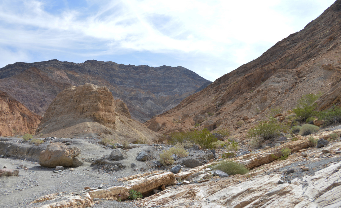
After leaving the increasing crowds at the falls, we turned back west over Towne Pass to Stovepipe Wells where we took one more detour to Mosaic Canyon.  Mosaic Canyon is another popular hiking destination, a fact quite evident by the number of cars squeezed into the parking lot.  We spent an hour or so wandering up through the shallow canyon, admiring the slick rock chutes and conglomerate mosaic walls that the canyon is named after.  The canyon was beautiful, but the crowds were becoming a little aggravating after spending so much time away from civilization and the afternoon was rapidly approaching.  Reluctantly we returned to the car, made a quick lunch stop, and started up the highway for good, leaving the memories and experiences of Death Valley in the rear view mirror.

Our return journey took us north from Tonopah past Round Mountain and Eureka, eventually depositing us back on the freeway at Carlin.  After our final camp dinner at a rest area somewhere in Nevada, we rolled into Elko after dark and got a motel for the night, tired after a long day of exploration and driving.  We rose with dawn of the ninth and final day of our adventure, and after a quick stop for coffee and a pastry we pulled onto the freeway and headed the truck towards Idaho and Montana.  The last day of driving followed the same route as we had taken on the way down, but the lack of wind made it much more enjoyable.  Idaho eventually passed under our tires and afternoon saw us crossing the state line back into Montana.  By evening we were pulling into the driveway, tired and happy to be home, but sad to be leaving such a wonderful adventure in the past.

Death Valley was a wonderful experience.  In a year where things just aren't going well, nothing heals the soul like getting out in nature and exploring the world.  We left with a greater appreciation for the area, its narrow and craggy canyons, its flat and seemingly endless basins, its dry searing heat, and its lush wildflowers and scattered streams.  When I bought a new truck last year and started fitting it out for overland travel, this is exactly what I was hoping for.  The ability to get out and enjoy the world, to explore places and see sights that many people will never experience.  Although Death Valley may be a distant memory by now, it has left a lasting impression on both Ashley and I, and we look forward to writing the next chapter in the adventure soon!

DV4-85.jpg
DV4-87.jpg
DV4-88.jpg
DV4-89.jpg
DV4-90.jpg
DV4-91.jpg
DV4-92.jpg
DV4-93.jpg
DV4-94.jpg
DV4-95.jpg
DV4-96.jpg
DV4-97.jpg
DV4-98.jpg
DV4-99.jpg
DV4-100.jpg

A Death Valley Spring Part 3 - The Racetrack

Miss the first part of the adventure?  Check out blog posts one and two:
A Death Valley Spring Part 1 - Echo Canyon
A Death Valley Spring Part 2 - Troubles in Titus

Day 5 (Continued)

After our morning exploration of the lower reaches of Cottonwood Canyon, we returned to the scene of the previous day's adventures and rolled into the parking lot at the west end of Titus Canyon.  Unable to find a parking spot in the small gravel lot, we pulled in at the end of the line of overflow cars along the access road and set about preparing for the hike.  Sunscreen was applied, hiking boots were donned, sandwiches and snacks were packed, and water bottles were topped off.  A hikers trail leads from the parking lot to the mouth of the canyon, first cutting across the mid section of several small alluvial fans before climbing up a small drainage to the edge of a steep embankment above the wash of Fall Canyon.  Although a short walk, the exposed south-west facing rock slopes combined with the mid day sun soon had us sweating, and the steep scramble down into the wash of Fall Canyon was met with expectations of shade and a pleasant canyon to come.  Gaining the bottom of the wash we struck out up the canyon, the rock walls slowly converging on us and gaining in height as we wandered further into the chasm of the canyon mouth.  After navigating the first couple bends of the canyon we found ourselves face to face with a large recessed alcove in the wall of the canyon.  The shady sand benches carved out at the base of the rock looked like a perfect place for a lunch stop, so we found a nice seating area in the shade and dove into our sandwiches and chips.

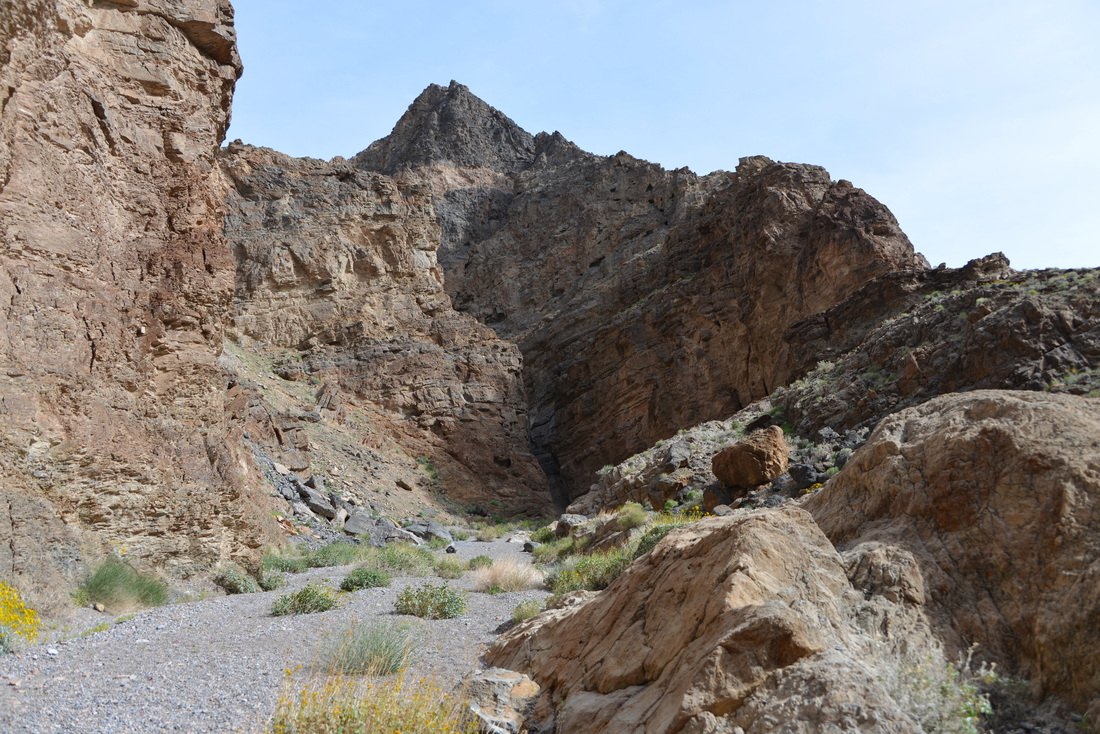
Our lunch stop proved to be an exceedingly pleasant one and we lingered in the shade as we finished our lunches, relaxed, and checked out the guidebook to get an idea of what Fall Canyon had in store for us.  Once we were refueled and prepared for the hike, we reluctantly left the shady comfort of our alcove and continued on into the mountain.  The lower portion of the canyon presented us with towering walls alternating between cool shade and intense sunshine.  The gravely wash was speckled with the purples, yellows, and whites of wild flowers, and the hiking was pleasant as we worked our way through the labyrinth of towering bends.  After about 2.5 miles we reached a small side canyon entering from the left, dwarfed by an enormous boulder towering in the middle of the large amphitheater formed by the confluence of the two canyons.  The side canyon begged for a quick exploration and we were only too happy to oblige.  We wandered up the narrow canyon a couple hundred yards until progress was stopped by a roughly 20 foot dry fall.  Not wanting to disturb the hiker lounging in the shade, we admired the fall from a distance before returning to the main canyon.  The next mile or so passed in much the same way as the previous reaches of the canyon, and before long we found ourselves face to face with the 25 foot dry fall that gives Fall Canyon its name.  This cliff would be daunting to all but super-humans with gecko suction powers, but fortunately a bypass requiring only a short scramble is situated just down canyon.  Having heard rave reviews of the narrows above the fall, we scrambled up to the bypass and soon regained the bottom of the wash past the stony obstacle.

We were not disappointed.  The canyon above the dry fall boasts the most impressive narrows we saw on the trip and we were left in awe by the smooth, narrow, undulating walls of the canyon.  Maybe it's due to my upbringing in the mountains of the north, away from the slot canyons and slick rocks of the southern deserts, but there is something magical about these places.  No matter how many times I explore them, they always manage to surprise me around every corner and leave me wanting more!  The next mile and a half of the canyon passed much to quickly and after what seemed like only a matter of minutes we were exiting the final narrows.  By this time the afternoon was rapidly expiring and we had seen only one other hiker after exiting the narrows.  Figuring we had gone a solid five miles up the canyon, we resolved to find a nice shady alcove to rest our legs before turning around and retracing our steps back to the truck.

DV3-1.jpg
DV3-2.jpg
DV3-3.jpg
DV3-4.jpg
DV3-5.jpg
DV3-6.jpg
DV3-7.jpg
DV3-8.jpg
DV3-9.jpg
DV3-13.jpg
DV3-15.jpg
DV3-16.jpg
DV3-17.jpg
DV3-18.jpg
DV3-19.jpg
DV3-20.jpg
DV3-21.jpg
DV3-22.jpg
DV3-28.jpg
DV3-30.jpg
DV3-31.jpg
DV3-32.jpg

The hike back down the canyon was a peaceful and relaxing affair.  Late afternoon sunlight played across the lofty walls and only occasionally were we sharing the trail with other hikers.  Exiting the canyon we found ourselves back on the hot, dry slopes which we had traversed earlier in the day, and, after passing the Asian Disco Party working their way along the trail, party music included, we arrived back at the truck and relieved ourselves of our packs and hiking boots.  The setting sun bathed the mountain peaks as we cruised north along the highway to the Grapevine Ranger Station where we took the road to Ubehebe Crater and the Racetrack, once again leaving the pavement in favor of a dusty dirt path.  The Racetrack Road led us into a broad mountain valley as it climbed its way towards a low pass crowned with a Joshua Tree forest.  Dusk overcame us as we began to descend the pass, turning the Joshua Trees into ghostly figures with groping arms outstretched in convoluted positions.  The dimming light began to hide the severe washboard of the road, and progress slowed as vision was obscured and tiredness set in.  We had been hoping to camp somewhere along the Racetrack Road, but no camp sites had presented themselves and we were becoming increasingly anxious to find our home for the night when the decorated sign of Teakettle Junction ventured into the beams of our headlights.  Since camping is prohibited between Teakettle Junction and the end of the Racetrack our best option for a quick campsite seemed to lie up the Hidden Valley Road.  Our patience was rewarded when we entered the dark shadows of the mountains and a perfect camping pullout presented itself on the side of the road at the foot of a scrubby mountain side.  We gratefully parked the truck and soon were devouring dinner under the bright moonlight.

DV3-33.jpg
DV3-34.jpg
DV3-35.jpg
DV3-36.jpg
DV3-37.jpg
DV3-38.jpg
DV3-39.jpg
DV3-40.jpg
DV3-44.jpg

Day 6

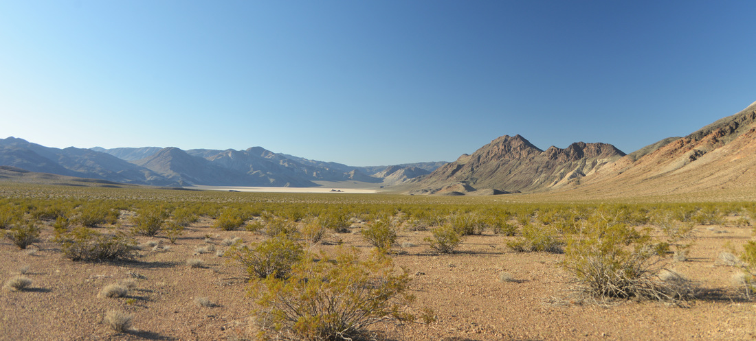
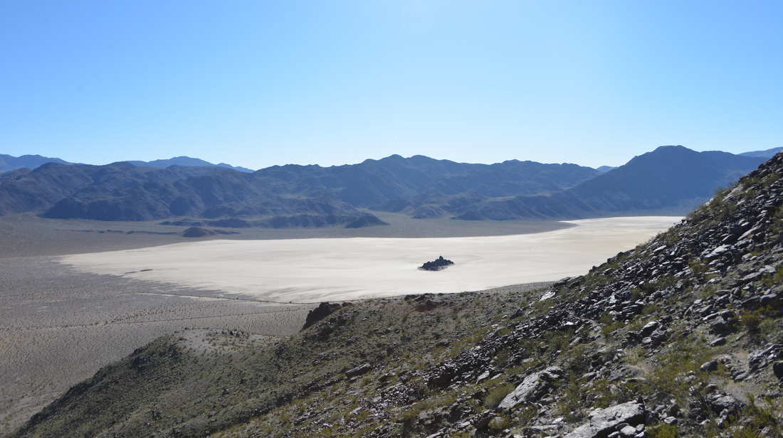
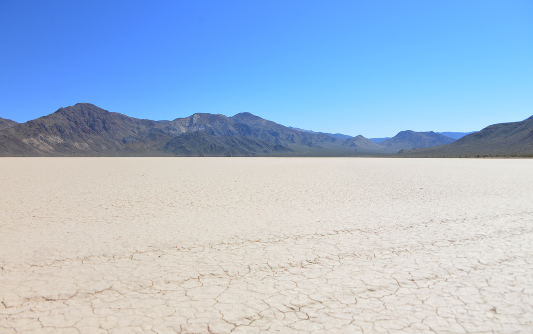
We arose the next morning as the first gray light began to illuminate the recesses of the canyon.  Crawling out of the back of the truck we were greeted by a bitingly cool breeze drifting down the wash.  Wanting to get an early start for our hike up Ubehebe peak, we took our cue from the wind and quickly packed up camp and hit the road.  Munching on cereal and granola bars, we bounced along the washboard as the sun rose above the dry lake bed known as the Racetrack.  Finally we reached the parking area for the Grandstand, a dark monolith of rock jutting eerily from the playa, and parked the truck to begin our exploration.  After a quick investigation of the racetrack we put on our hiking boots, packed lunch, and set off up the trail.

The route up Ubehebe peak is one of the few hikes in Death Valley National Park that boasts a traditional trail.  The old path carved into the mountain side by determined miners once served as a pack route by which burros transported ore down from the mines perched in the gullies of Ubehebe Peak.  The mines have long since been abandoned and the mule trains are but a distant memory, but the determination of the hearty people who called this place their office is astonishing.  The challenges with mining and surviving in such a remote and unforgiving environment boggle the mind.  Climbing the switchbacks up to the pass in the early morning light, we pondered those who had pioneered the trail and admired the striking views of the Racetrack and the broad valley we had driven through.  From the first pass the trail took us over the smaller peak just north of the main summit before, much to our dismay, dropping us back down the elevation we had just climbed into the saddle below Ubehebe peak.  The last push to the summit is devoid of trail, and hikers are left to find their own route through the sharp and rugged rock of the mountain side.  A faint hikers trail can be seen at times, aided by a few scant cairns, but a good route finding eye and a willingness for mild scrambling are a must to conquer this last stretch.

A little before noon I finally crested the final boulders and found myself on top of the world!  Well, at least on top of the 5,678 foot tip of Ubehebe peak...  The idea of climbing a mountain peak less than 1000 feet higher than that of my house felt a little funny, but the elevation ascended and the views from the top made it seem like I was standing on any of the 8000+ foot peaks back home.  Ashley joined me on top a few minutes later and we marveled in the views of the Racetrack, Saline Valley, and the surrounding mountains towering in the distance.   We spent about an hour on top of the peak enjoying the fruits of our toils, soaking in the mid day sun while enjoying our lunches and the breathtaking scenery.

DV3-46.jpg
Teakettle Junction with Ubehebe Peak in the background on the left side.

Teakettle Junction with Ubehebe Peak in the background on the left side.

Nestled among the teakettles was a single hiking boot which looked out of place, and kind of new to be abandoned. Upon closer inspection the writing along the side revealed a mischievous coyote had absconded with the right one...

Nestled among the teakettles was a single hiking boot which looked out of place, and kind of new to be abandoned. Upon closer inspection the writing along the side revealed a mischievous coyote had absconded with the right one...

DV3-49.jpg
DV3-50.jpg
DV3-51.jpg
DV3-52.jpg
DV3-53.jpg
DV3-55.jpg
DV3-56.jpg
DV3-57.jpg
DV3-58.jpg
DV3-59.jpg
DV3-60.jpg
DV3-61.jpg
DV3-62.jpg
DV3-64.jpg
DV3-70.jpg
DV3-71.jpg
DV3-72.jpg
DV3-73.jpg
DV3-74.jpg

Unfortunately, we couldn't revel on the top of Ubehebe peak forever, and early afternoon saw us covering the last few paces back to the trail head.  Tired and hot from our hike, we set up the camp chairs in the shade of the truck and let our feet breathe freely in the desert air.  We had been planning on walking out to the Grandstand after the hike, but the midday sun beating down on the dry playa looked particularly menacing after our morning exertions so we decided to climb back in the truck and begin our journey back to the pavement.

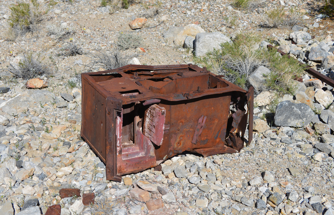
Since the afternoon was still young we had plenty of time for a couple sight seeing stops along the way.  First up was a quick side trip to the Ubehebe Mine, located down a short spur road just south of Teakettle Junction.  The Ubehebe Mine originated as a copper mine before transitioning to one of Death Valley's most productive lead-silver mines in the mid 1920s.  The mine was opened around 1900 and by 1908 had a 25 foot tunnel that had produced promising results.  The mine was dormant for a few years before restarting around 1915 with an increase in led prices.  It was then intermittently active until the mid 1920s when the mine hit its peak production.  The shipment of 258 tons of high-grade ore in 1928 marked the height of production for the area, and although the mine operated off and on until 1968 it never came close to reaching that mark again.  If you are interested in a deeper history of this mine, or any of the locations referenced in these stories, check out Hiking Death Valley by Michel Diconnet for a wealth of reading!  Today, the remnants of the mine consist of the earth workings and structure of the aerial tramway sprinkled with a few collapsing structures.  We spent a half hour exploring the relics of a past time, pondering over the ruins that had held the hopes and dreams of the many men who had worked this claim.

DV3-76.jpg
DV3-78.jpg
DV3-79.jpg
DV3-80.jpg
DV3-81.jpg
DV3-82.jpg
DV3-84.jpg
DV3-86.jpg
DV3-87.jpg
DV3-88.jpg
DV3-89.jpg
DV3-90.jpg

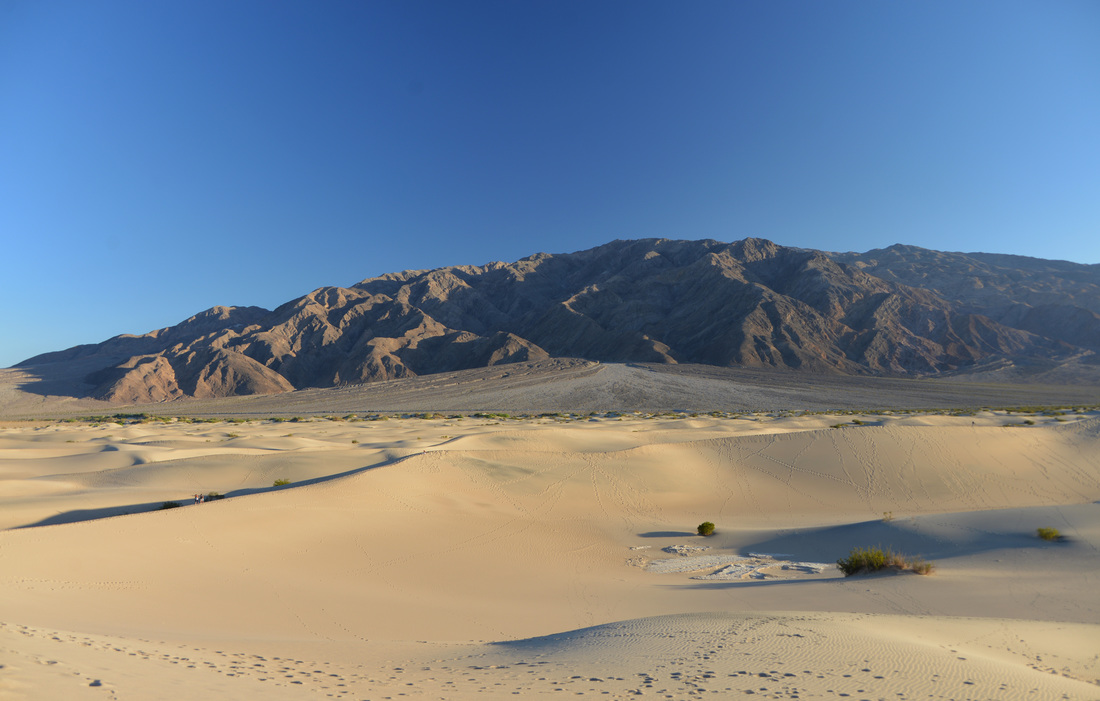
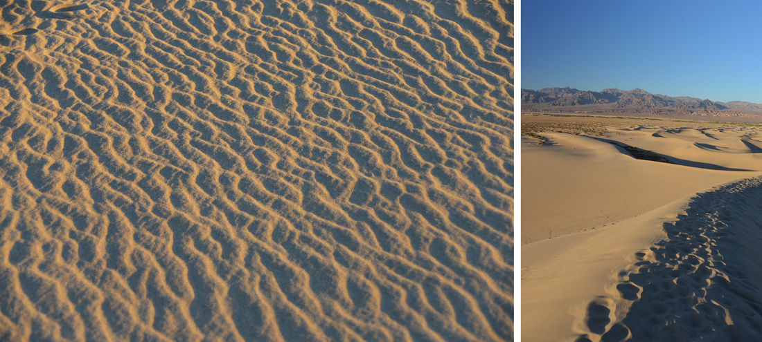
After getting in our old mine fix, we returned down the Racetrack Road, through the Joshua Tree forest, and finally left the washboard in favor of the smooth asphalt at Ubehebe Crater.  Taking advantage of the Crater's parking area, we indulged in a needed break to stretch our legs and take a peak into the depths of the volcanic scar before turning our attention back south towards Stovepipe Wells and the sand dunes at Mesquite Flat.  The Mesquite Flat Sand Dunes are the most frequently visited sand dunes in the park as they are conveniently located right by the main highway running west from Stovepipe Wells.  It just so happened that this was the same highway that we needed to take to reach Panamint Springs for our evening camp, so a sunset walk out on the sandy mountains was in order.  As a small child many years ago I had enjoyed a solitary sunset dinner during a family trip at these very same dunes.  Those days are long past and this time we found ourselves jostling for a parking spot before joining the crowds infiltrating the recesses of the sand dunes.  Luckily, it is easy to spread out over this barren landscape and we were able to find a secluded path up to the tallest dune while the evening sunlight painted the sand a beautiful hue of gold.

Tired and satisfied after a long day's adventure, we returned to the truck and headed over the mountains into Panamint Valley.  The Panamint Springs development is as relaxed as you are likely to find in a National Park, and the local, down to earth flavor is refreshing after fighting crowds at the other visitor centers and popular attractions.  It was dark when we backed into the roadside parking in front of the restaurant, and we gladly exchanged our seats in the truck for chairs on the patio in the comfortable evening air.  The rest of the night was spent enjoying cold beer and cheeseburgers before driving out to the Lake Hill road where we camped for the night.  Finally crawling into bed, we reminisced at the adventures we had enjoyed thus far, and looked forward with anticipation to the trip's final hike the coming day.

DV3-91.jpg
DV3-92.jpg
DV3-94.jpg
DV3-95.jpg
DV3-96.jpg
DV3-97.jpg
DV3-98.jpg
DV3-99.jpg
DV3-100.jpg
DV3-101.jpg
DV3-102.jpg
DV3-103.jpg
DV3-104.jpg
DV3-105.jpg
DV3-106.jpg
DV3-107.jpg

A Death Valley Spring Part 2 - Troubles in Titus

Miss the first part of the adventure?  Check out A Death Valley Spring Part 1 - Echo Canyon!

Day 4


Sunrise over Echo Canyon found Ashley and I enjoying breakfast with a view and sipping coffee as we decided on the plan for the day.  Due to running around looking at campgrounds the afternoon we had arrived, we had not visited some of the "quick hit/touristy" places we had thought we might check out.  Since we were close, we decided the first order of business for the day would be a quick walk up Natural Bridge Canyon.  This is a popular and short walk up a shallow canyon with strikingly sheer walls, culminating in an impressive natural bridge spanning the canyon.  We pulled into the parking lot and found a place to slip in between the passenger cars and motor homes and started up the trail.  A quick and easy walk up the wide wash brought us to the natural bridge, an impressive arch of rock towering almost 40 feet above the canyon bottom forming one of the largest natural bridge arches in the park.  On the north side of the arch you can still see a deep recess about 8 feet above the canyon bottom where the old channel had been before the natural bridge was carved.  Since the walk was so short, we continued up the canyon until the 15 foot dry fall that ends the exploration for all but the most prepared rock climbers.  Above the bridge we were treated to several sloping dry falls and chutes to scramble up, all surrounded by "dripping wax" mud features and a few intriguing side canyons.  We paused to admire the dry fall at the end of the canyon, but a drive through Titus Canyon and a hike up Fall Canyon (the trail-head of which is conveniently located at the exit of Titus Canyon!) were on our list for the day so there was no time to waste!  Leaving the foreign tourists to their chest mounted GoPros, we descended the canyon and returned to the truck.

DV2_1.jpg
DV2_2.jpg
DV2_4.jpg
DV2_5.jpg
DV2_6.jpg
DV2_7.jpg
DV2_8.jpg
DV2_9.jpg
DV2_10.jpg
DV2_11.jpg
DV2_12.jpg
DV2_13.jpg
DV2_14.jpg
DV2_15.jpg
DV2_16.jpg

The Titus Canyon road is one way heading east for much of its length, only the last couple miles from Scotty's Castle Road to the mouth of the canyon are open to two way travel.  In order to access the entrance for our drive we would need to travel within six miles of Beaty on the highway we had entered the park by a couple of days earlier.  Because the price of fuel in the park was just this side of astronomical, we decided it would make sense to take a quick detour into town to top off the tank.  Having completed this task we hit the road a little after noon, anxious to complete the drive through Titus Canyon so we could explore Fall Canyon on foot.  Despite having read some information on the Titus Canyon drive previous to the trip, we were quite naive on what the canyon had in store for us...

The first part of the road went as smoothly as expected.  After a brief stop for a picture at the Titus Canyon sign, we followed the washboard dirt road across a vast scrubby plain, eventually climbing some gentle hills up to a low pass with some beautiful views of the surrounding peaks and valleys.  Since the book had not mentioned anything about two passes we assumed that we had reached the pass referenced by the author.  Continuing down a few broad switchbacks into the valley below, we commented on the steep, narrow switchbacks of an old mining road across the valley.  The mood was light and something like "look at those switchbacks, glad we're not going up there!" was uttered.  A couple minutes later we passed the first troubling sign, an older Toyota pickup high centered on the downhill roadside berm just above a tight switchback.  Wondering why anyone would park in such a position we drove alongside the vehicle, only to realize that whoever had parked it there hadn't done it by choice.  The drivers side front wheel was at a rakish angle in the fender, with untold damage in the control arm area it obviously wasn't going anywhere soon.  How they were going to remove the disabled rig is a problem we couldn't solve, and the "oh @#%&" moment that must have coincided with the incident is one we didn't wish to imagine.  A few turns later the truck started to point directly up those steep switchbacks we had been laughing at moments earlier and the realization of our miscalculations began to sink in...

The climb up to Red Pass was certainly memorable.  The road sits perched on a steep hillside, with breathtaking vistas down below into the canyons, if you have the confidence to look down that is.  Although not bad enough to cause any problems for the truck, the switchbacks and turns were tight and steep.  One particular hairpin bend around a point with significant exposure featured a nice slick rock incline polished by countless tires where any slippage would be particularly unpleasant to imagine.  Switching the truck to auto 4WD, just in case, we continued up to the pass.  As breathtaking as the road up was, the view from the pass was magnitudes greater.  Unfortunately the small pullout at the top of the pass was already filled by a couple of rigs, so we had less time to enjoy the sights than we would have liked.  The drive down the backside of Red Pass was equally as daunting as the climb, featuring hairpin switchbacks, sharp drop-offs, and spectacular views thousands of feet down into the canyon bellow.  Reaching the old mining town of Leadfield, we were finally able to relax a little.  Ashley's fear of heights had been alive and well on the pass, and I was glad to have a break from the concentration of driving on such roads.  Taking advantage of this opportunity, we parked the truck and took a minute to get out of the car and stretch our legs.

DV2_17.jpg
DV2_18.jpg
DV2_19.jpg
DV2_20.jpg
DV2_21.jpg
DV2_23.jpg
DV2_24.jpg
DV2_26.jpg
DV2_27.jpg
DV2_28.jpg
DV2_29.jpg

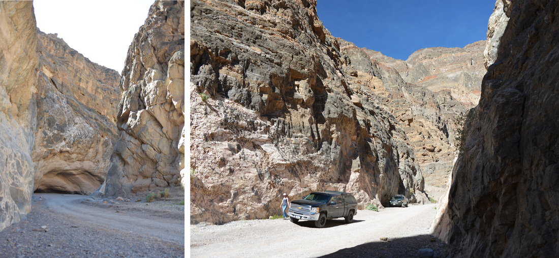
We would have liked to explore the ruins of Leadfield some but time was not on our side.  The afternoon was quickly passing and we were not even close to ticking off our goals for the day.  Climbing back into the truck we continued to descend into Titus Canyon and before long found ourselves entering an ever tightening set of spectacular cliff walls.  By this point we had agreed that, being so late in the afternoon, we did not have time to hike Fall Canyon and give it the exploration it deserved.  Instead of driving out to the Racetrack that evening, we decided to rearrange our plans and instead spend the night at Marble and Cottonwood canyons, returning to the west end of Titus Canyon (via the two way road from the highway of course) to hike Fall Canyon the next day.  Although we had wanted to spend more time in the Marble and Cottonwood area, we knew we couldn't fit it all in as we had originally hoped and this seemed like the best option to salvage time where we really wanted it.  With this decision made, we relaxed our pace and enjoyed the amazing scenery the canyon presented around every bend.  After many stops to examine the tight walls, wildflowers, and vistas of the Titus Canyon narrows, we emerged from the shadows of the gorge into the light of the expansive alluvial fans and paused to stretch our legs at the parking area.  In spite the damage done to our plans and our lack of mental preparedness for the journey over Red Pass, Titus Canyon proved to be one of the most spectacular drives of the trip and I hope to repeat the journey some day!

DV2_31.jpg
DV2_37.jpg
DV2_38.jpg

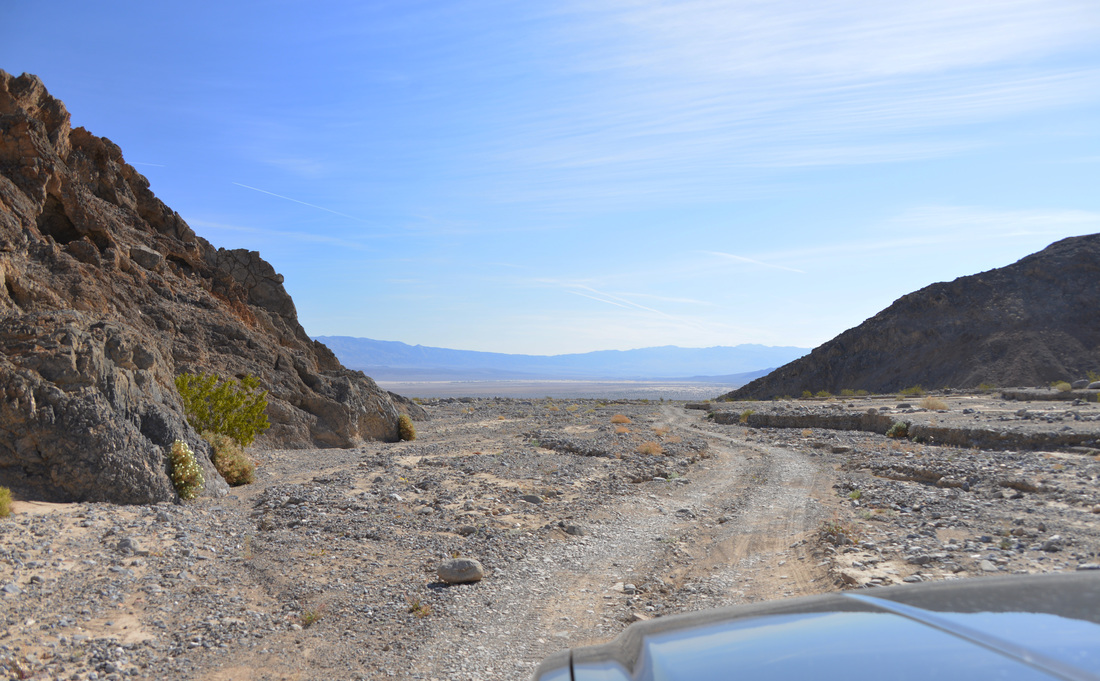
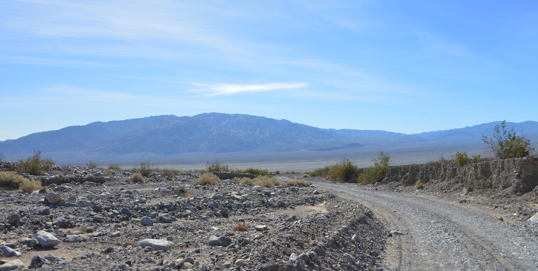
It was well past 3:00 when we turned off the highway at Stovepipe Wells.  On a hunch we turned down towards the "airstrip" and were rewarded by the entrance to the dirt track we were searching for.  Driving past a sign proclaiming the presence of sand holes and poor traction for the next few miles, we started off over the flat, sandy washboard towards the mountains.  Other than a mild sand hole at the entrance to the road, the warning of sandy conditions proved to be overly exaggerated, although the potential for trouble would be great if the wind picked up or you strayed off the security of the traveled way.  Finally leaving the washboard behind for a smoother ride up an alluvial fan we found ourselves at the base of the mountains and the entrance to the canyon.  Here the road took a swift turn for the worse, and we found ourselves jostling over large rocks through the wash bottom and weaving our way through boulders, brush, and narrow canyon bends.  This was definitely the rockiest road of the trip and going was slow.  Adding to the adventure was how obscure the road became at times as it wove in and out of the wash, one such location required a pause to determine where the road had disappeared to before continuing!

However, the roughness of the road was offset by the equally impressive scenery we passed through.  The canyon wash had cut a massive winding gap through the first row of mountains guarding a surprisingly large and flat basin created by the confluence of Marble and Cottonwood canyons.  We passed the faint "road sign" demarcating the fork in the roads and, taking the right fork up Marble Canyon, soon found ourselves at the end of the road.  From here on the canyon is a wilderness area, so we parked the truck and set out for a much needed stretch of the legs in the setting light.  We were both tired from a long day of off road driving and the stroll between the striking rock walls of Marble Canyon was a refreshing change.  Shaded in the cool darkness of the canyon at dusk, we wound our way through its bends and marveled at the convoluted rock formations that appeared from around every turn while the peaks along the rim of the canyon glowed in the warm sunlight of the setting sun.

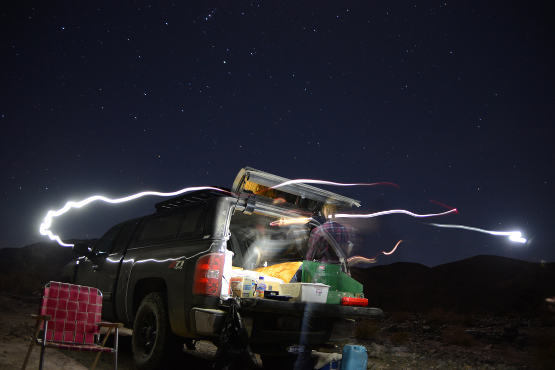
Unfortunately our time in Marble Canyon was destined to be short lived.  After spending around 45 minutes exploring, the growing dusk forced us back to the truck to find a camp site before darkness fell.  We paused to give encouragement to a couple wondering if they had found the right road for Marble Canyon, and then continued back to the fork in the road.  Taking the road up Cottonwood Canyon we soon found a nice campsite below the striking conglomerate wall of the wash and set about making camp, cleaning up, and getting dinner going.  Soon we were joined by a group of five or six bats that darted around us and the truck as they hunted for their dinner, even leaving streaks in the dust on the truck as they skimmed the hood.  As quickly as they had appeared the bats were gone, and we were left to enjoy our dinner alone under the clear desert sky.

DV2_39.jpg
DV2_40.jpg
DV2_41.jpg
DV2_42.jpg
DV2_43.jpg
DV2_44.jpg
DV2_45.jpg
DV2_46.jpg
DV2_47.jpg
DV2_48.jpg
DV2_50.jpg
DV2_51.jpg
DV2_52.jpg
DV2_53.jpg
DV2_55.jpg
DV2_56.jpg

Day 5

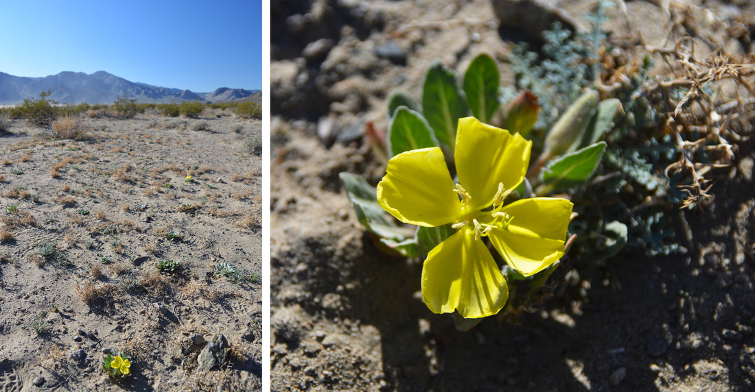
After a quick breakfast we set out for a short walk before returning to the Titus Canyon road for our much anticipated hike up Fall Canyon.  The warm morning sunlight shone down on us as we strolled up the sandy bottom of Cottonwood canyon, following the two track road as it meandered in and out of the wash.  Soon, a small but intriguing side gully appeared a few hundred yards away on the opposite side of the drainage.  My proposition to explore it was quickly seconded so we cut across country and worked our way up into the boulder strewn gully.  The shallow side channel wound its way through the hills in bends alternating between sheer conglomerate cliffs and gradual scrubby hillside.  Large boulders were scattered frequently throughout the reaches of the drainage and we quickly were forced to scramble up and around these obstacles.  After spending half an hour working our way up the gully it was time to head back to the truck and hit the road.  The drive out of the canyon was uneventful and pleasant and before we knew it we had returned to the washboard of the sand flats.  We (somewhat) unintentionally blew through the final sand hole at a good 35mph, leaving a cloud of dust billowing behind us, and returned to the highway, anticipation of the afternoon's hike high on our minds.

DV2_58.jpg
DV2_59.jpg
DV2_60.jpg
DV2_61.jpg
DV2_62.jpg
DV2_63.jpg
DV2_64.jpg
DV2_65.jpg
DV2_66.jpg
DV2_67.jpg
DV2_68.jpg

A Death Valley Spring Part 1 - Echo Canyon

Death Valley National Park had not been a place I had been thinking about recently, and going there hadn't even crossed my mind, when a little video popped up on my Facebook feed one day.  The video talked about how the El Niño rains of the fall and winter were creating a bloom of wildflowers in the barren desert park special enough to be labeled as a "super bloom" year.  That's when the idea struck.  I realized that without a job, the travel bug starting to gnaw away, and nothing preventing me from traveling, this just might be the remedy the doctor had ordered for my so far rocky spring.  I did some research, ordered a map and a guide book (Hiking Death Valley by Michel Diconnet, a great book with excellent references and historical information, all historical antidotes in the following write-ups come from his guide), and set about planning the adventure.  And so I found myself, a few weeks later, dragging myself out of bed at 4:00 AM on a Saturday morning, throwing a few last minute things into the truck, and saying my goodbyes to Lex (Unfortunately, due to strict National Park regulations on pets I had decided it would be best to leave my trusty side kick at home for this trip).  A couple of friends had been interested in joining but had been detained by the rigors of school and work, and so it was only Ashley and I that hit the road before sunrise that Saturday.

Day 1

Dawn found us cruising the main street of Island Park.  All 33 miles of it.  Apparently, due to state liquor laws banning sales outside of city limits, resort owners decided to incorporate the area into a "town," and claim it as the longest "main street" in the world.  I can't speak for length, although I will say it must have the most speed limit changes on any "main street" in the world...  Idaho Falls, Pocatello, and Twin Falls passed by the windshield, and we finally found ourselves entering Nevada's border town of Jackpot around noon.  We filled up our tanks with gas and PB&J sandwiches and resumed pounding the pavement.  A determined head wind tried its best to rebuff us, but we prevailed and dusk found us rolling into Tonopah Nevada.  We cruised down the main street, surrounded by desert mountain tops and the ruins of mining's heyday, and pulled into the parking lot of the Mizpah Hotel.  The Mizpah is a historic hotel that was recently renovated, and boasts period furnishings, as well as several period ghosts.  The spirits in residence are said to include a murdered prostitute, two children, and two miners supposedly murdered by a third after tunneling from the Hotel's basement to the bank vault next door.  We quenched our hunger with delicious barbecue and beer at the Tonopah Brewing Company before crawling into bed, tired after a long days drive.

DV1_1.jpg
DV1_2.jpg
DV1_3.jpg

Day 2

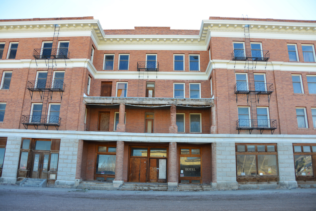
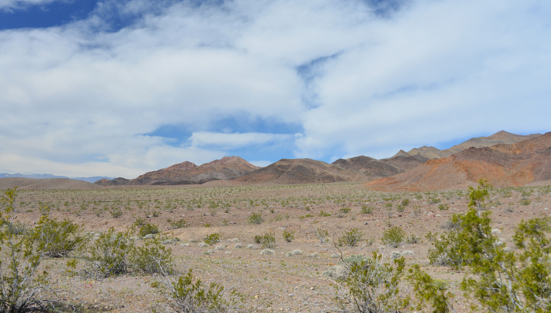
No ghosts visited us during the night, and we awoke the next morning refreshed and ready to go!  Fueled by coffee and muffins, we loaded the truck and turned the wheels towards Beaty, NV.  The road took us through the old mining town of Goldfield, now nothing more than a few houses, tourist shops, and the crumbling remains of the town's once grand hotel.  The Goldfield Hotel is supposed to be quite haunted and has featured on several paranormal TV shows.  After a quick stop at Goldfield, we soon found ourselves rolling across the state line into California, and into Death Valley National Park.  Stopping at the kiosk to pay our entrance fee, we were greeted with our first views of the park, and its first offerings of wild flowers.  Neither disappointed.

DV1_4.jpg
DV1_5.jpg
DV1_6.jpg
DV1_7.jpg
DV1_8.jpg
DV1_9.jpg
DV1_10.jpg
DV1_11.jpg
DV1_12.jpg
DV1_13.jpg

The original plan had been to find a campsite at the Wildrose campground or one of the other three campgrounds that do not have a charge for camping (my aversion to paying for a campsite if at all possible had narrowed our choices).  With this in mind, we decided to find a home for the next few days before we did any exploration.  Passing by the Mahogany Flat Sand Dunes and Stovepipe Wells Village, we soon found ourselves at the junction of the Wildrose Road and the Emigrant campground.  Emigrant campground turned out to be nothing more than a large gravel parking lot with picnic tables, and even had there been a spot available, there was no way we were staying there.  Wildrose campground was the next to be eliminated.  The campground was nice, but the road to get to it is long, extremely windy, and it quickly became apparent that driving in and out of it everyday would be impractical and quite annoying.  With the other two free campgrounds even farther up Wildrose road, we decided that backcountry camping off one of the many back roads of the park would be the way to go.  Not only would it be more pleasant, it would allow us to move our camp close to the next days objective, allowing us more time to explore.  Why I even considered the campgrounds over backcountry camping I will never know, but it was the best decision of the trip, and I will not consider anything else when the next trip comes around!

With the decision made, we returned to the main road and passed through Furnace Creek towards Echo Canyon.  After missing the discretely signed turn off for the 4WD road we turned around and made it on the second attempt.  Numerous people were camped along the gravely wash but we easily found a nice camping spot just downhill from the mouth of Echo Canyon proper.  We explored a bit of the lower canyon on foot and climbed to a nice vantage point above camp before setting up for the night and throwing some steaks and potatoes on the stove for dinner.  We enjoyed dinner and the night sky before turning in for the night, excited for the first full day of exploration!

DV1_14.jpg
DV1_15.jpg
DV1_16.jpg
DV1_17.jpg
DV1_18.jpg
DV1_19.jpg
DV1_20.jpg
DV1_21.jpg
DV1_22.jpg
DV1_23.jpg
DV1_24.jpg
DV1_25.jpg
DV1_26.jpg
DV1_27.jpg
DV1_28.jpg
DV1_29.jpg
DV1_30.jpg
DV1_31.jpg

Day 3

Fresh coffee in hand, we pilled back into the truck and continued up the Echo Canyon road.  The road follows the wash of the canyon and consists mostly of loose rock, with a few small boulders thrown in to make line choice a little more interesting.  Although it is not a particularly narrow canyon, the steep rock walls come within a foot of the road at places, and around every bend we were greeted by dramatic desert scenery and wild flowers.  After about a quarter of an hour the steep walls began to retreat as the canyon opened up into a striking high desert valley, and before long we were pulling into the parking pullout at the old Inyo Mine with only one other car and none of its occupants to be seen.  This is the end of the road for most travelers, though dedicated jeepers can continue up a different fork of the road over a mountain pass and eventually back into the Beaty area.  We had passed a large group of Jeeps coming up the canyon so we decided to take advantage of the solitude and put boots to the ground before more people swarmed the area.

Inyo Mine consists of half a dozen buildings in various states of collapse scattered across the base of the hillside.  The remnants of the old gold mill tower over the west side of the camp and a small dugout shelter from the early 1900s lurks on the far end.  The east side of the camp contains the old boarding house and the old cook house.  The main mines are located high on the hillside above the camp, the main shaft marked by the large ore bin perched on the steep slope.  Additional mine shafts are scattered around the hillside and hidden on the backside of the mountain.  Gold was first discovered here in 1905 by Maroni Hicks and Chet Leavitt, and by the spring they had staked claims on all of the most promising locations.    By the end of the year a group of Utah mining investors bought the claims and the Inyo Gold Mining Company was incorporated.  The mine was developed for the next two years with most work occurring in the winters, employing up to 30 miners.  However, the ore was not good enough that it could be profitably shipped without milling, and by 1907 when the great financial panic struck, the company was in debt and the mine closed by the end of the year, remaining idle for several subsequent years.  In the mid 1930s the mine was leased to a new owner and revived, producing and shipping mid-grade ore until lack of funds caused the mine to close again in 1938.  Although the mine produced a small quantity of high grade ore in the subsequent years, it was not enough to sustain continued mining in such a remote location, and the mine shut down for good in 1941.

DV1_32.jpg
DV1_33.jpg
DV1_34.jpg
DV1_35.jpg
DV1_36.jpg
DV1_37.jpg
DV1_38.jpg
DV1_39.jpg
DV1_40.jpg
DV1_41.jpg
DV1_42.jpg
DV1_43.jpg
DV1_44.jpg
DV1_45.jpg
DV1_46.jpg
DV1_47.jpg
DV1_48.jpg
DV1_49.jpg
DV1_50.jpg
DV1_51.jpg
DV1_52.jpg
DV1_53.jpg
DV1_54.jpg
DV1_55.jpg
DV1_56.jpg

As with all old mining areas it would be easy to spend an entire day exploring the relics of a bygone age, but we had other sights to see and the Jeep group had arrived and were crawling over the area like ants.  Taking our cue, we reluctantly said goodbye to Inyo Mine and retraced our tracks down the canyon.  The drive back down was uneventful until we came around a bend and came face to face with The Eye of the Needle, which had eluded us on the drive up that morning.  After taking a break for a few pictures around this unique arch we exited Echo Canyon and soon were rolling on pavement once again.  The pavement was not destined to last long, however, as Hole in the Wall and an afternoon hike up Slit Canyon was on our list next!  Right after a drive through 20 mule team canyon that is...

DV1_57.jpg
DV1_58.jpg
DV1_59.jpg
DV1_60.jpg
DV1_61.jpg
DV1_62.jpg
DV1_63.jpg

The Hole in the Wall road proved to be a little rougher, but our destination was not far, and before long we found ourselves face to face with the feature the area is named after.  The Hole in the Wall is a large gap in a striking barrier of upthrusted conglomerate towering 300 to 400 feet above the wash, pockmarked with cavities resembling a block of Swiss cheese, that bisects the alluvial fans coming out of the mountains.  This was to be our trail head for the afternoon, so we parked the truck, loaded some PB&Js and snacks in our packs, and set out up the wide wash and alluvial fans towards the mouth of Slit Canyon.  The mouth of this canyon is tucked back in the mountains and is quite hidden from a distance, but our estimate proved to be accurate and the canyon mouth presented itself as we climbed up the fans.  Less than a quarter of a mile into the canyon we came face to face with the first obstacle, a sharp 90 degree bend in the canyon guarded by a set of two climbable dry falls around 12 to 18 feet high standing at the foot of an impassible 25 foot dry fall that must be bypassed to continue up canyon.  We decided this would be a good place to lighten our packs of the lunches we packed, so we found a nice rock to relax on and enjoyed our sandwiches in the shade of the canyon's towering walls.

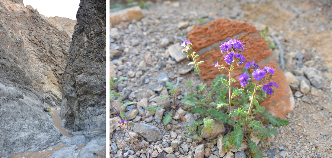
After a quick climb up the first fall for the sake of exploration, I rejoined Ashley and we proceeded to scramble up the wall of the canyon on a rough hikers trail, descending back to the canyon wash upstream of the dry falls.  Upon reentering the wash we found ourselves in a classic desert canyon with narrow walls towering above us and an assortment of dry falls to climb, most formed by steep patches of slick rock polished by raging water, others from large boulders long ago wedged in narrows and buried on their upstream side.  The most challenging of these falls resides at the end of the narrows which the guide book calls the Slit.  The Slit is a straight and narrow passage only a few feet wide running for close to 100 feet along the canyon ending in a slanting 15 foot dry fall.  Although a fairly easy scramble, the last part of the climb is somewhat exposed and holds were small making for a bit of a challenge.  We continued on up the canyon, eventually reaching a stunning 50 foot dry fall, the focal point of which is a vertical chute about four feet wide and a two to three feet deep into the rock that runs the length of the fall.  This formidable obstacle is impassible, and required another scramble up and over a sub wall of the canyon to bypass.  Arriving back in the wash, the canyon continued to unfold in a series of narrows, small dry falls, all sprinkled with a generous allotment of wildflowers

DV1_64.jpg
DV1_65.jpg
DV1_66.jpg
DV1_67.jpg
DV1_68.jpg
DV1_69.jpg
DV1_70.jpg
DV1_71.jpg
DV1_72.jpg
DV1_73.jpg
DV1_74.jpg
DV1_75.jpg
DV1_76.jpg
DV1_77.jpg
DV1_78.jpg
DV1_79.jpg
DV1_80.jpg
DV1_81.jpg
DV1_82.jpg
DV1_83.jpg
DV1_84.jpg
DV1_85.jpg
DV1_86.jpg
DV1_87.jpg

The canyon was breathtaking, and every bend brought new sights, but all good things must come to an end, and the sun was sinking ever lower in the sky.  Exiting the canyon we were greeted with a spectacular view of the alluvial fans and Hole in the Wall awash in late day sunlight.  We marveled in the sun, the view, and the striking wildflowers as we descended back to the truck where we were met by an older couple bird watching and looking for a rare endemic wildflower.  After exchanging stories and locations where we had not seen their flower, we parted ways.  For us it was back to camp, our day was done.  The Zabriskie Point overlook was on our way back to camp in Echo Canyon, so we stopped and took in the view of the badland hills in the evening light before continuing back to our camp.  We settled down to fish tacos, hot chocolate, and the brilliant night sky before crawling into our sleeping bags, tired and satisfied after a long day of exploration, unaware of the challenges the next day had in store for us...

DV1_88.jpg
DV1_89.jpg
DV1_90.jpg
DV1_91.jpg
DV1_92.jpg
DV1_93.jpg
DV1_94.jpg
DV1_95.jpg
DV1_96.jpg
DV1_97.jpg
DV1_98.jpg
DV1_99.jpg
DV1_100.jpg
DV1_101.jpg
DV1_102.jpg