Montana

The Daisy Pass Expedition

Topping out at 12,807 ft at the top of Granite Peak and as home to the roughly 40 highest peaks in the state, the Beartooth Mountains are the undisputed roof of Montana.  The towering peaks are composed primarily of Precambrian granite and metamorphic rocks dated to approximately 2.7 to 4 billion years old, making them among the old rocks on earth.  The Beartooth range sits astride the Montana and Wyoming border to the North and East of Yellowstone National Park.  The Beartooths make up the eastern half of the 900,000 acre Absaroka-Beartooth Wilderness and are largely devoid of roads other than a few dirt access roads winding into the larger canyons. The notable exception is the Beartooth Highway. US route 212 climbs gradually from the Northeast entrance of Yellowstone Park to the 10,947 ft top of Beartooth Pass before plunging precipitously into Red Lodge, Montana.

Carl, Ashley and I had been talking about venturing into the Beartooth Mountains all summer. I had driven the highway many times but had explored little of the canyons around Cooke City and Red Lodge, and neither of my two companions had even driven the highway.  A first attempt at the trip  fell prey to time constraints, lack of planning, and serious lack of commitment issues, but this time it was on.  Carl was going down in the morning to hike with a friend in Yellowstone, but since Ashley had to finish up some work and I wouldn't be able to take Lex out hiking in the Park, the two of us would meet Carl at Roosevelt Lodge in the evening.

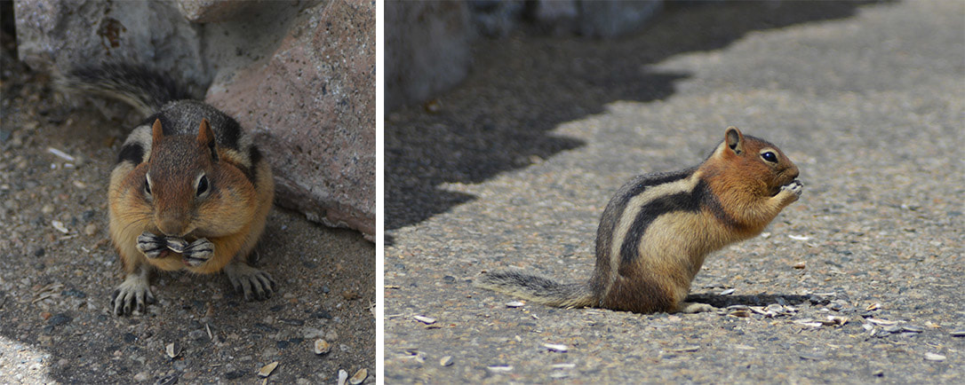
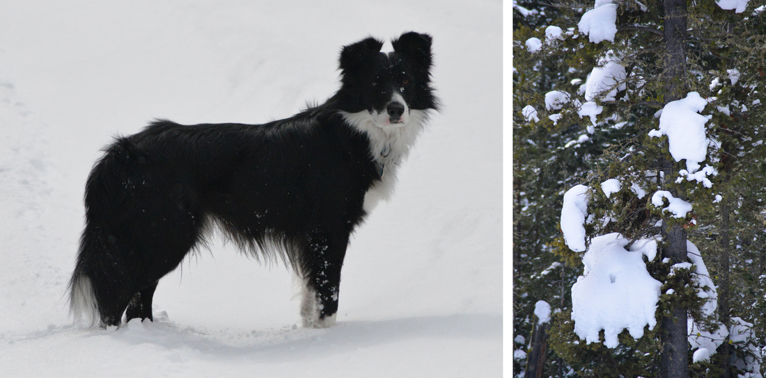
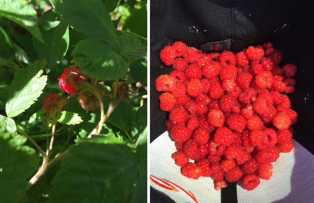
I met Ashley a little after noon and we loaded up the truck and headed east on the freeway.  We had decided that a quick stretch of the legs was in order before we started the drive down to the park, so we took the Trail Creek exit and released the hound onto the trail of Chestnut Mountain.  We enjoyed a nice relaxing hike up the mountain, soaking in the summer afternoon and the perfect weather before deciding it was time to hit the road.  However, before we could reach the truck, our plans were derailed by the discovery of wild raspberries.  Ashley spotted the first few berries peeking out of leaves right along the downhill side of the trail, and before we knew it we had worked our way into a massive thicket of the juicy red berries.  While we had started popping them in our mouths as quickly as we picked them,  it soon became apparent that the amount of berries we were encountering necessitated a more dedicated collection effort.  About an hour after the discovery we were finally climbing back into the truck, fresh raspberries in the cooler, and working our way south towards Gardner.  I had been expecting the worst at the Yellowstone entrance station, but we were pleasantly surprised by the lack of a line and we were soon cruising past the elk at Mammoth Village and rolling out of the hills into Tower Junction and Roosevelt Lodge.  We found Carl enjoying a cold beverage on the lodge's front porch and joined him for some relaxation in the rocking chairs before heading into the lodge to rustle up some grub.

BT_1.jpg
BT_2.jpg

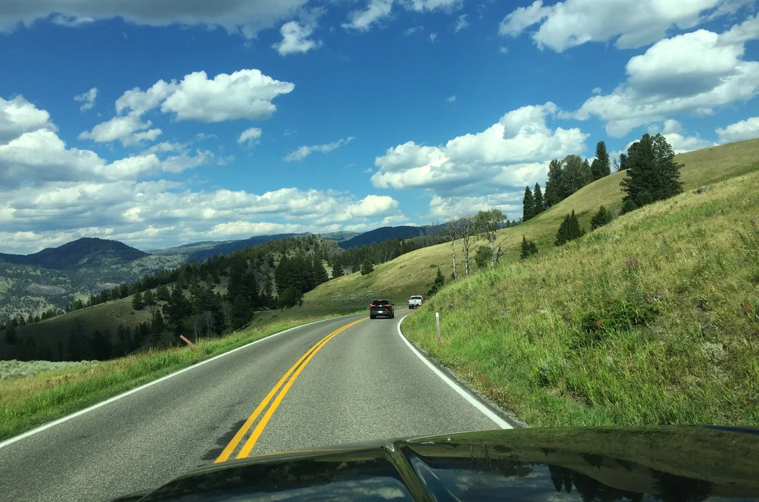
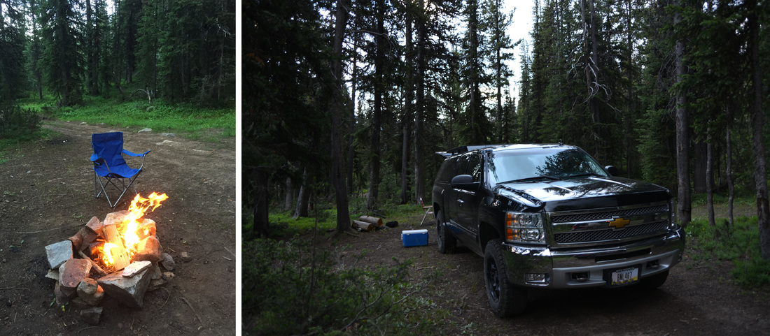
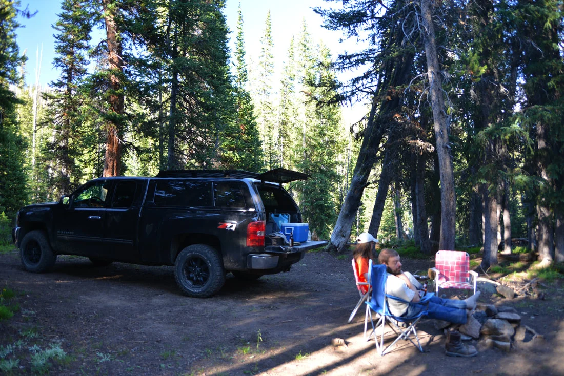
After filling up with burgers, fries, and tamales, we climbed back into the cars and hit the road to Cooke City.  It was a perfect summer evening and we were joined by a coyote family and the usual herds of buffalo as we enjoyed the scenery of the Lamar Valley.  Leaving the wildlife and tourists of Yellowstone in the rear view mirror, we passed through the quaint but touristy main streets of Silver Gate and Cooke City before finally reaching the Lulu Pass road, our planned camping area for the next couple nights.  Good camp sites were at a premium but we soon found a nice secluded spot behind the creek and set up camp for the night.  The fire ring was in a serious state of disrepair, but even the moderate swarm of mosquitoes and a light rain shower couldn't dampen our efforts and the fire ring was soon repaired and filled with a roaring camp fire.  S'mores and Smookies (a s'more with cookies instead of gram crackers, of course) were produced, and we finally crawled into the sleeping bags, ready for a good nights sleep and the coming day of adventure.

BT_3.jpg
BT_4.jpg

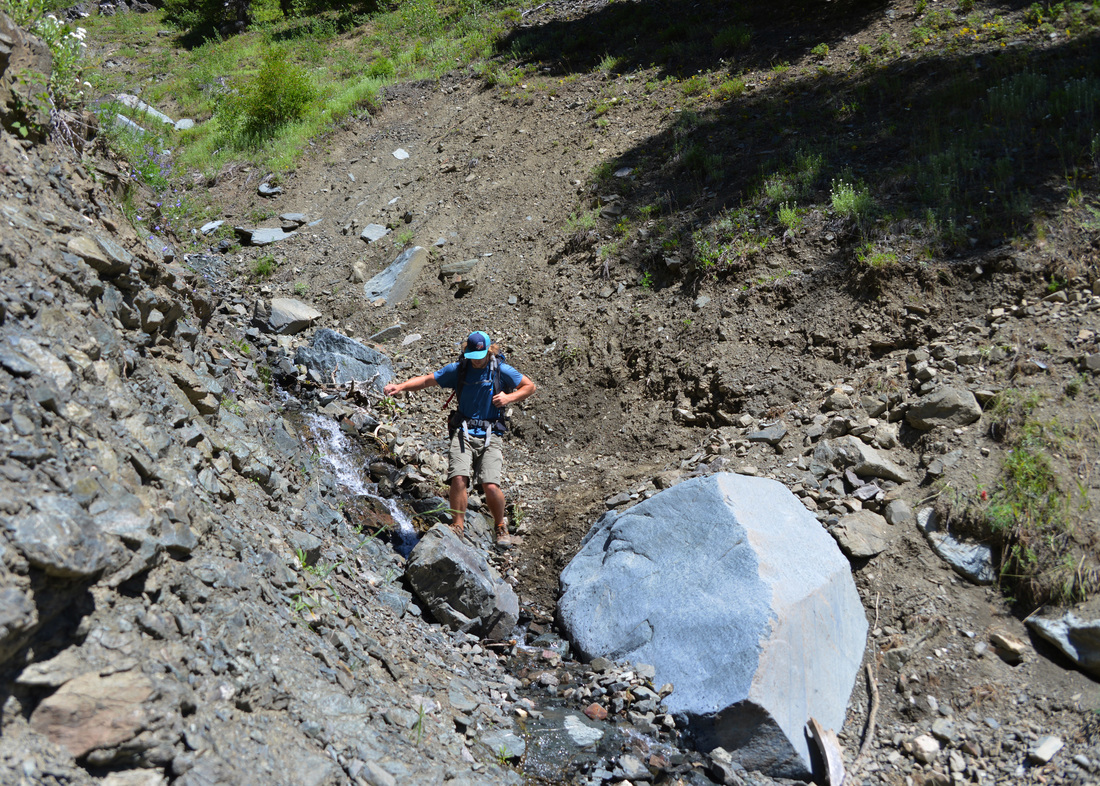
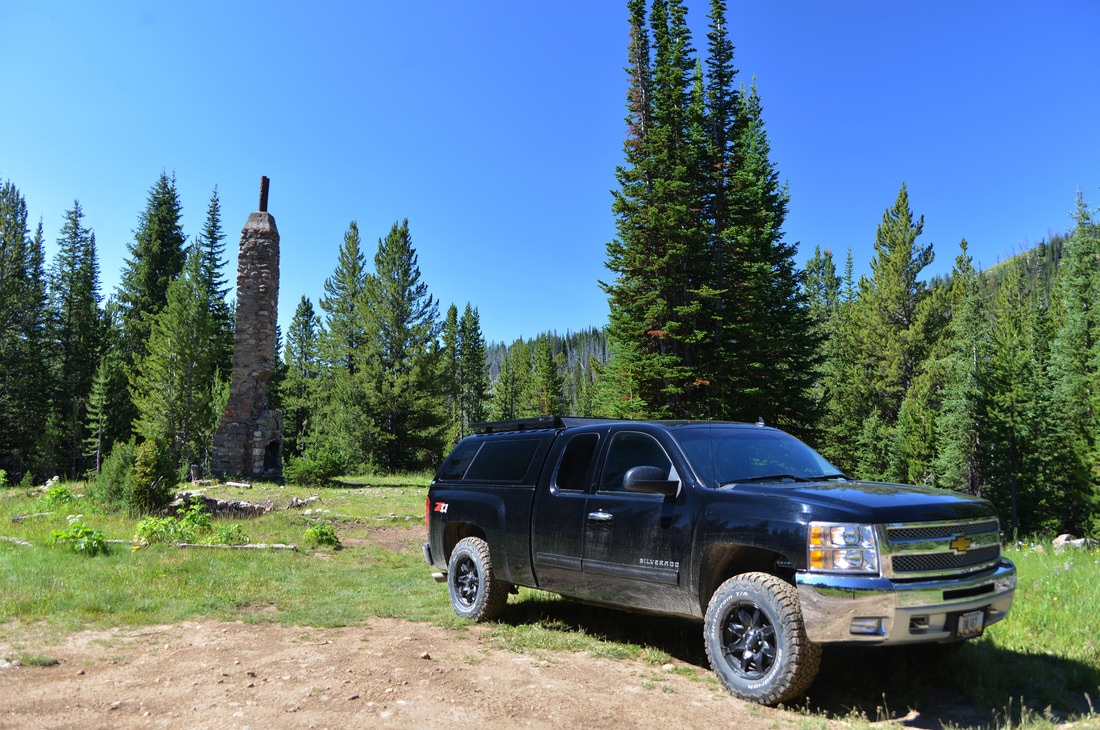
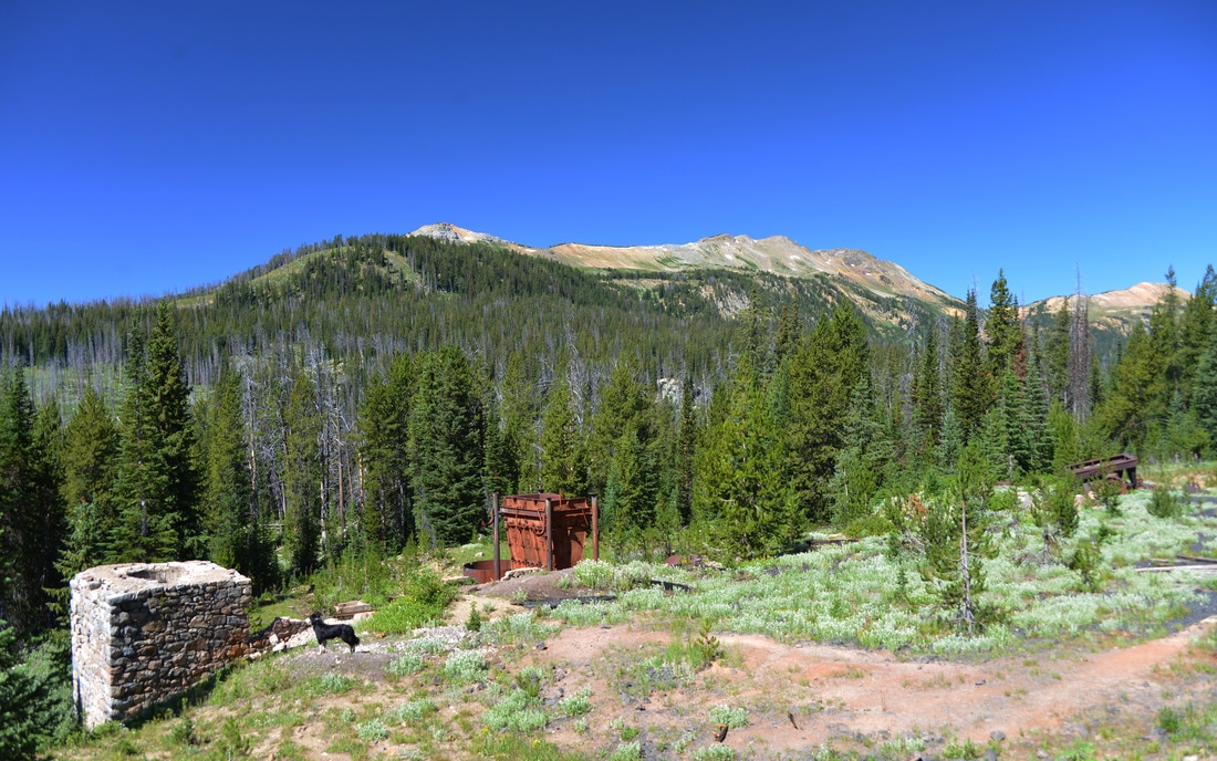
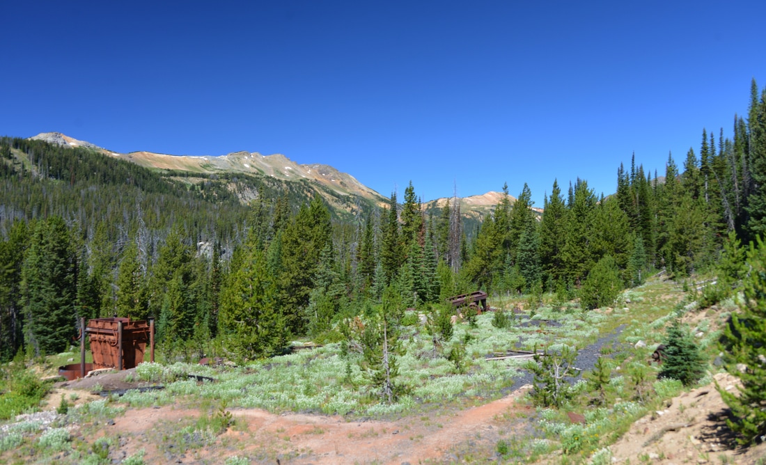
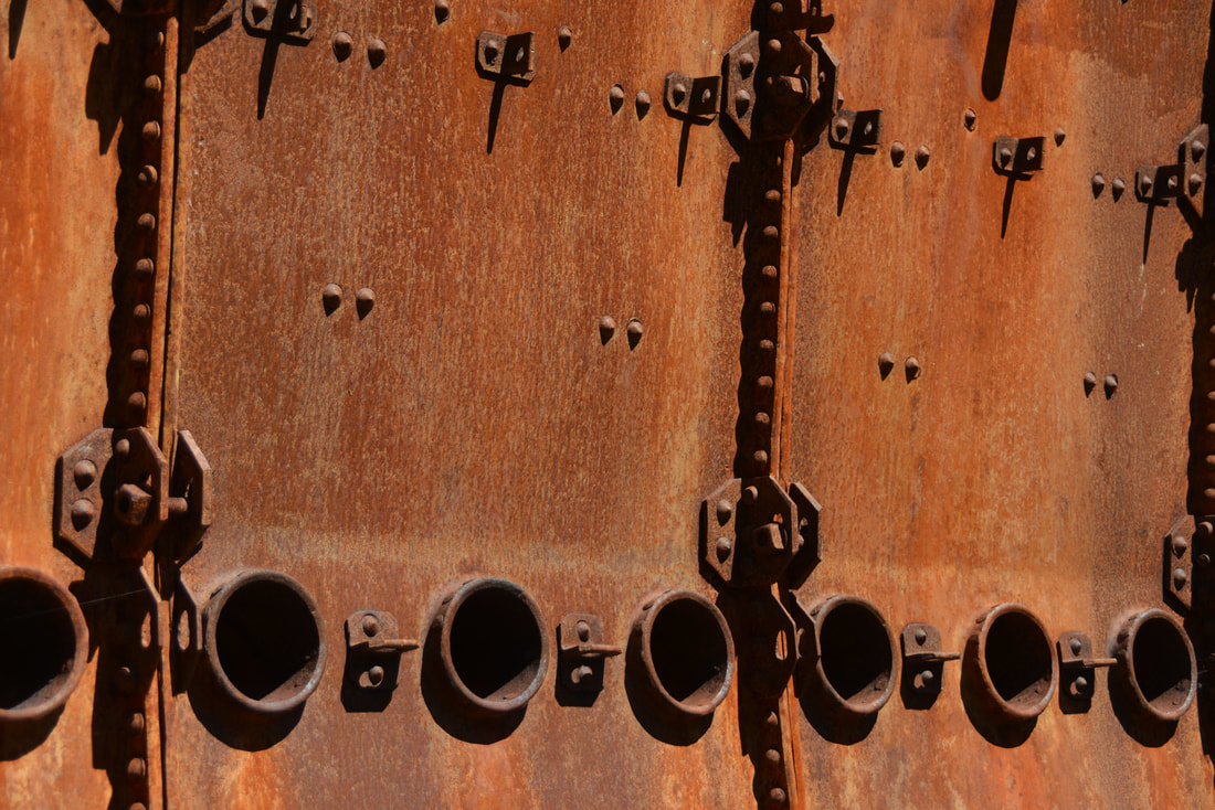
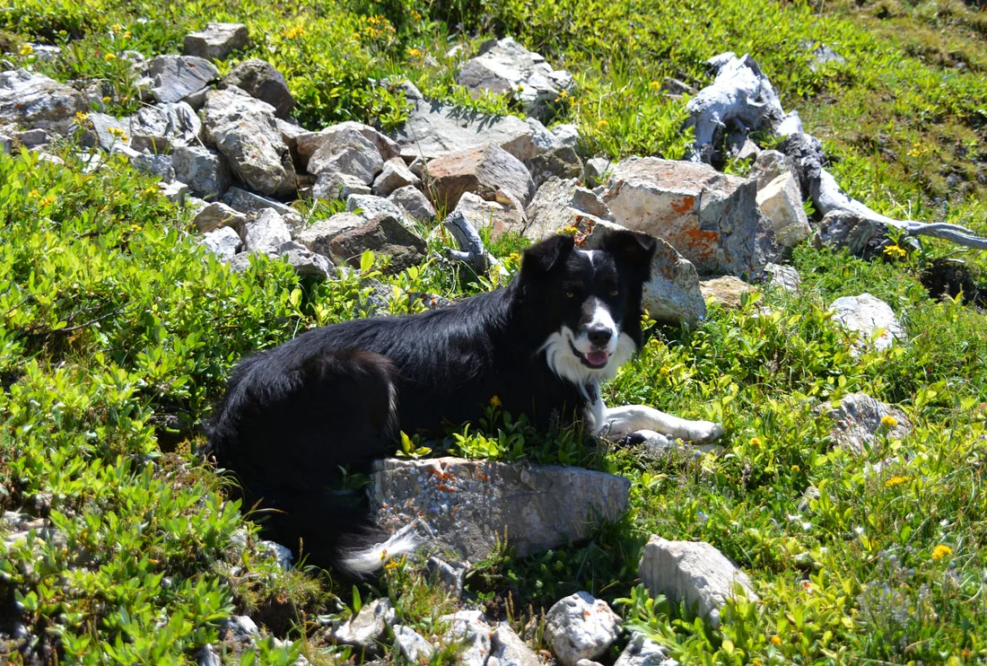
After a good night's sleep, we awoke to sunny skies and gorgeous scenery.  The cool mountain air was invigorating as we ate breakfast and pilled into the Raven, leaving Carl's car to guard our campsite.  The first stop of the day was an old mining area just up the Lulu Pass road that I had found while conducting some Google Earth surveillance.  We pulled off into a spur road and parked the truck at the remnants of an old building.  The towering bones of a stone fireplace and chimney stood watch over the skeletal remains of the old foundation and cellar.  While only a few ruins remained, it was clear that this had been a grand building in its day.  We poked through the rubble and explored the nearby twisted remains of metal track before working our way further down the dirt trail.  Reaching the end of the road, we found ourselves at a small trail head surrounded by derelict mining equipment, ramshackle cabins, and bullet hole riddled cars and machinery.  Two old cabins and discarded mining equipment in various states of disrepair were explored before walking down the hill into what had obviously been the main processing and milling area.  Rusted shells of equipment lay at rakish angles amongst the stone foundations of furnaces and buildings.  A massive hamper of some sort stuck out proudly from the discarded pipes, gears, and other forgotten machinery.  A large flattened bench dotted with footings appeared to outline the extent of one of the processing facilities.  Wondering about the people that built these workings and mined the hillsides, we clambered over the stone benches and explored the old wreckage while Lex performed the obligatory sniff test on all the pertinent objects under investigation.

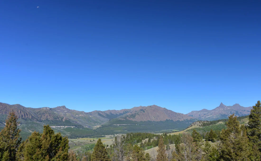
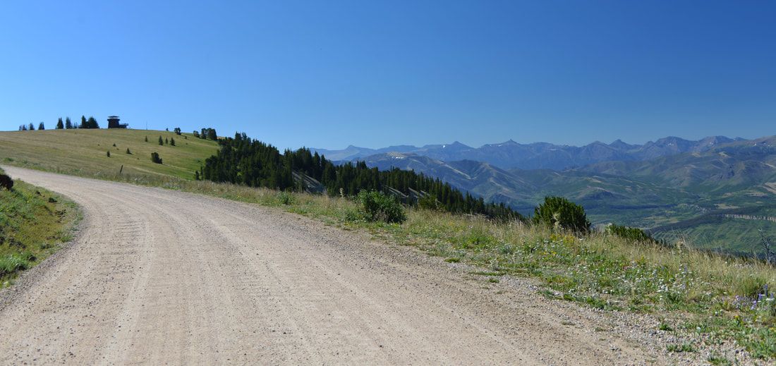
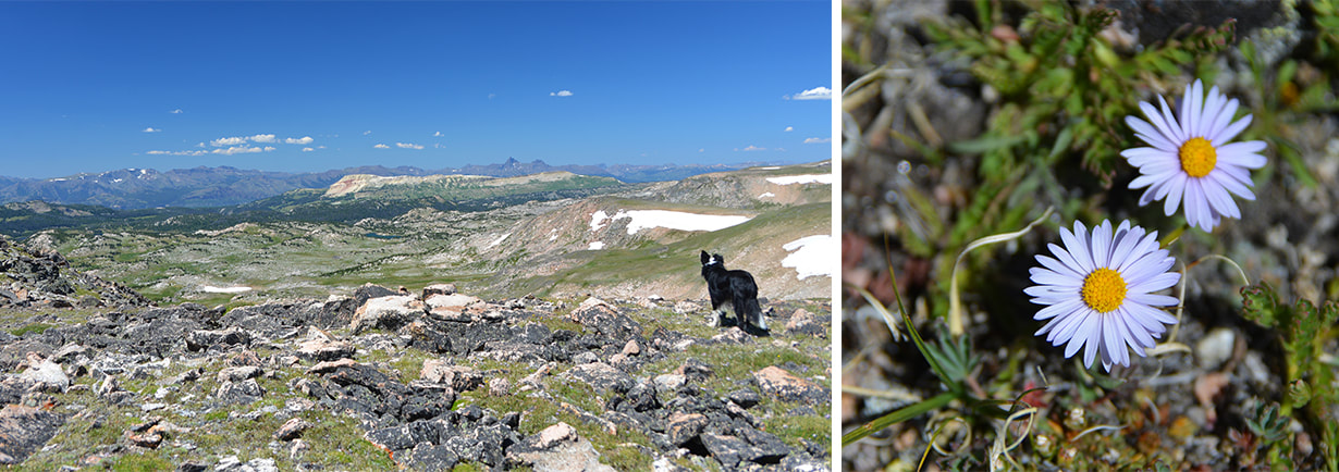
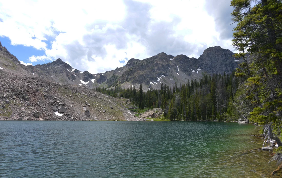
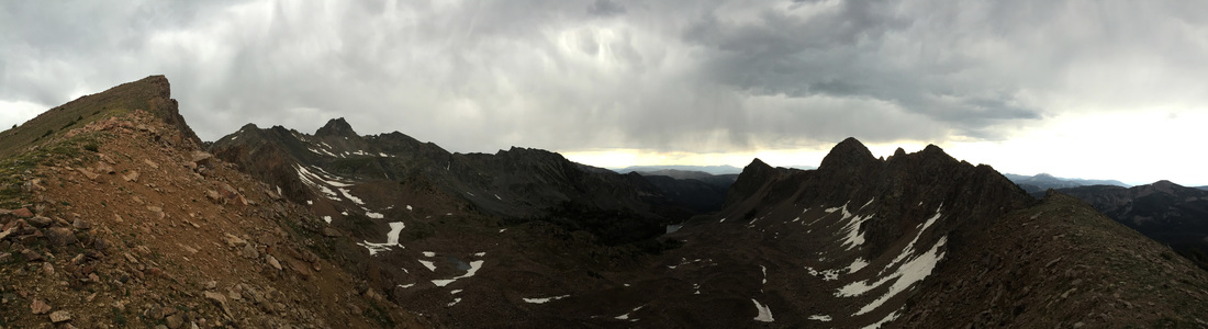
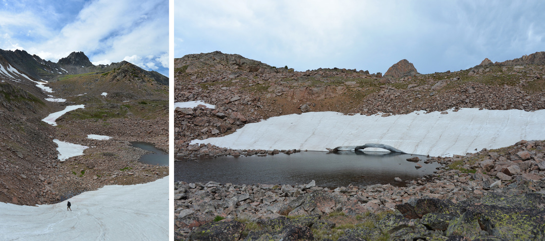
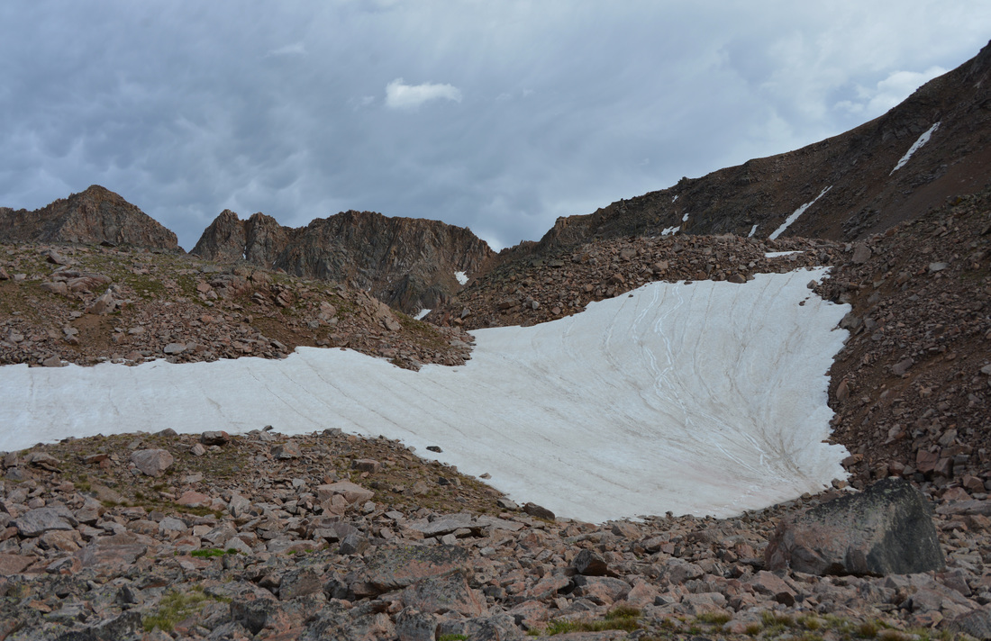
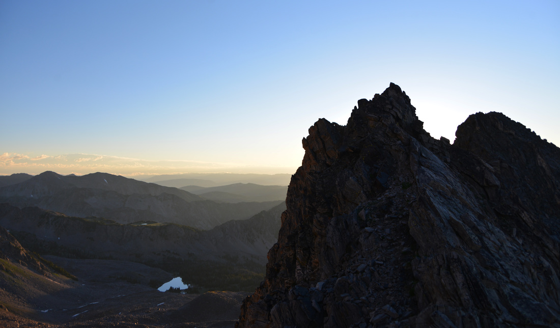
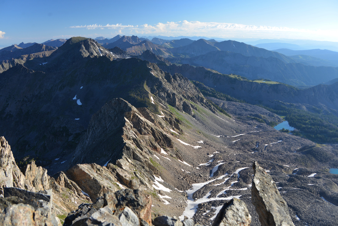
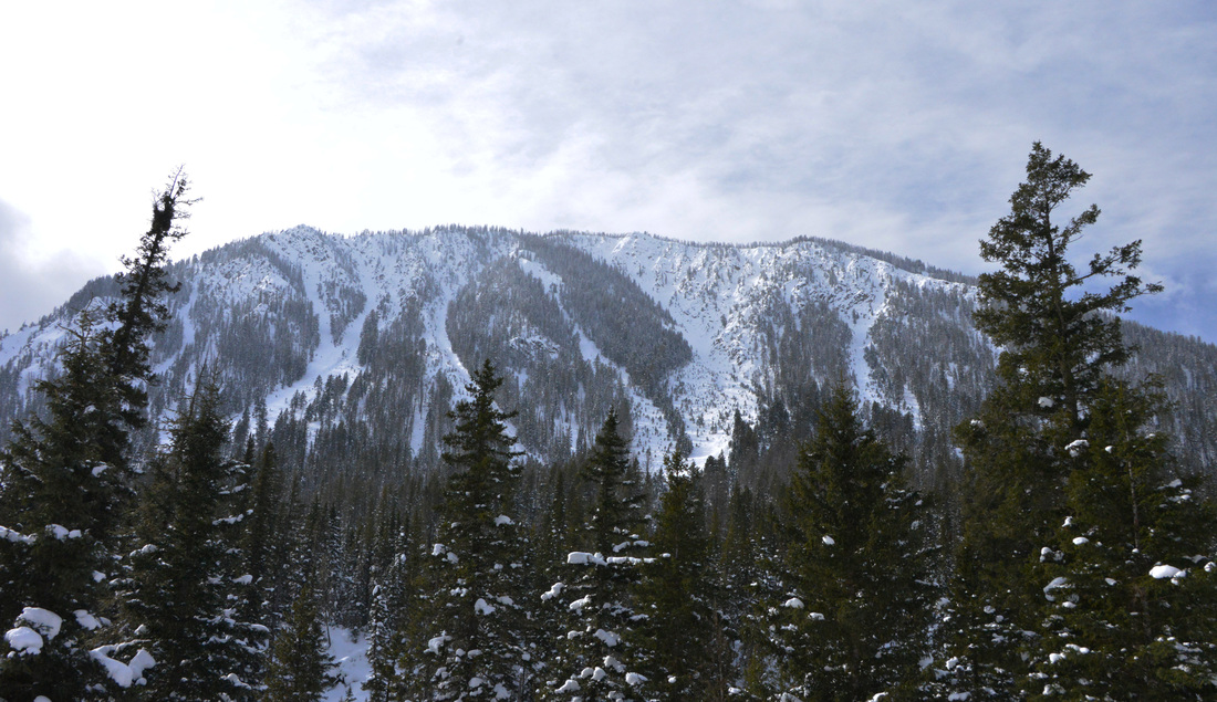
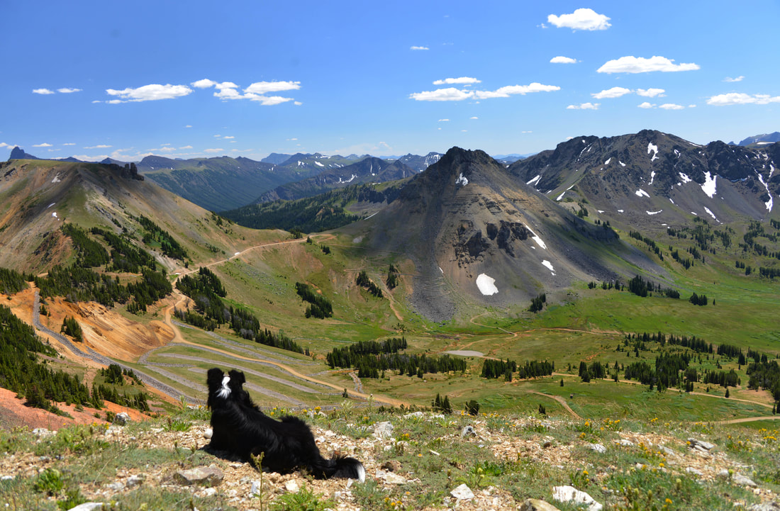
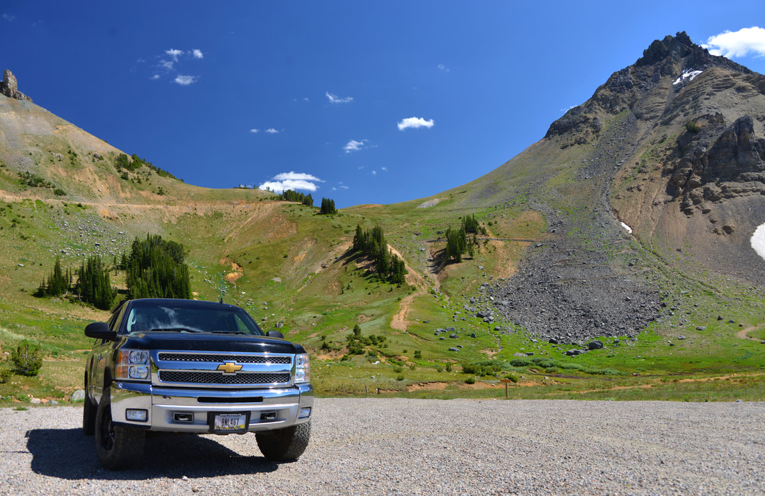
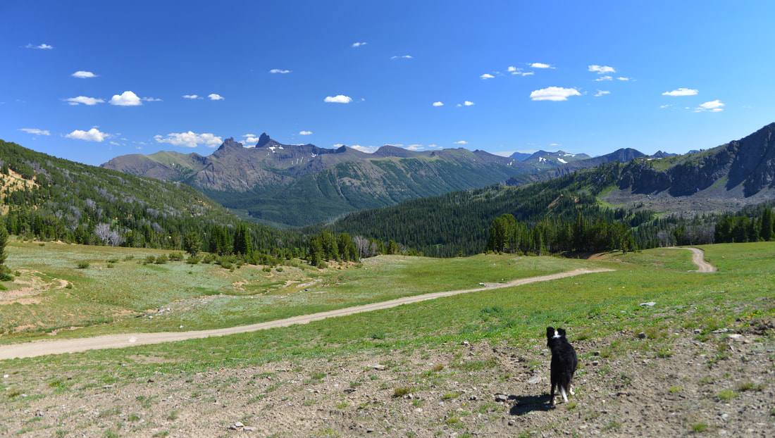
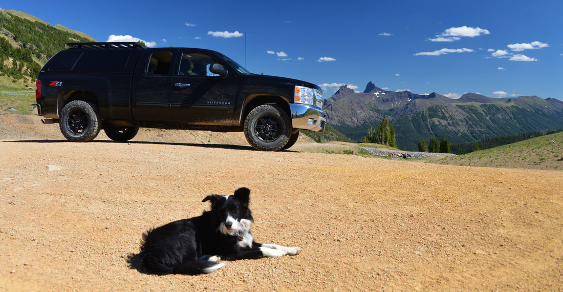
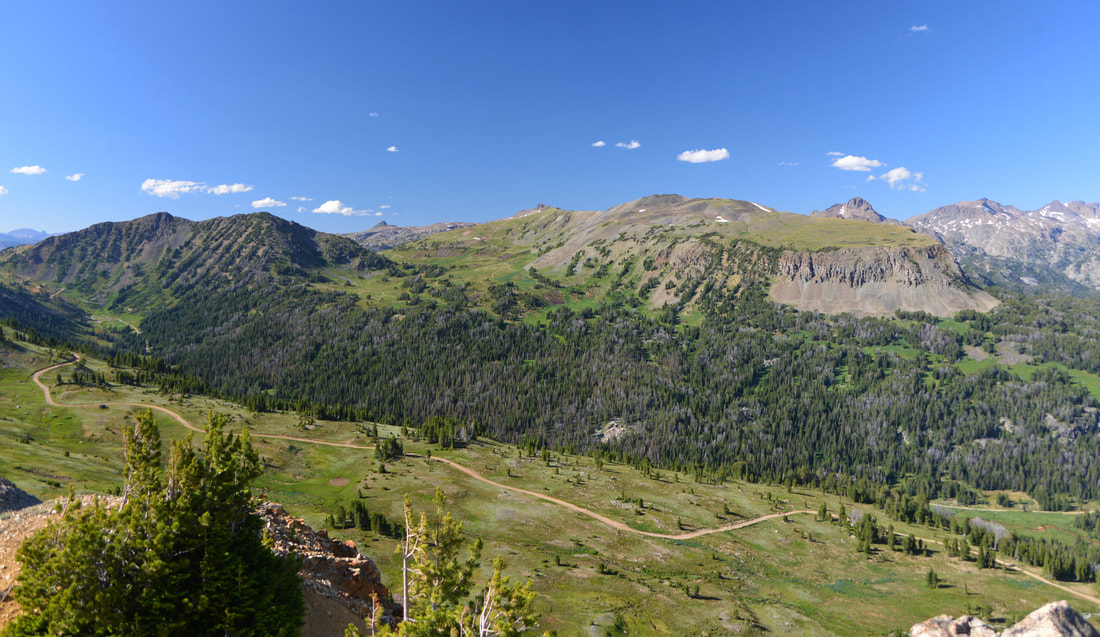
After satiating some of our curiosity, we hiked back to the road, loaded into the truck, and set out for Lulu Pass.  The road wound its way higher into the mountains past more relics of the bygone mining days and the run down cabins of the men who called these places home.  The road deteriorated as we climbed towards the pass, but the Raven was easily up to the task and only a couple of exploratory stops delayed our arrival on Lulu Pass.  We soaked in the stunning views from the pass; the craggy summits of Pilot and Index peaks sticking out from the ridge line to the south and the towering hulks of the high points around Montana's tallest peak, Granite Peak, to the east, all bathed in the mid day sun.  Such a breathtaking vista called for extended enjoyment, so we settled into a pullout on the flanks of Fisher Peaks and dived into sandwiches and snacks on the tailgate.

"Hey, its a beautiful morning, why aren't you getting up yet?"

"Hey, its a beautiful morning, why aren't you getting up yet?"

BT_7.png
BT_15.png
BT_16.jpg
BT_19.jpg
BT_22.jpg
BT_23.jpg
BT_25.jpg
BT_32.jpg
BT_36.jpg

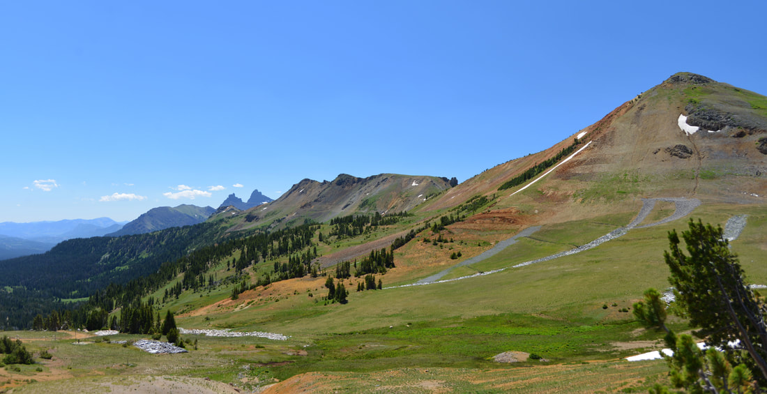
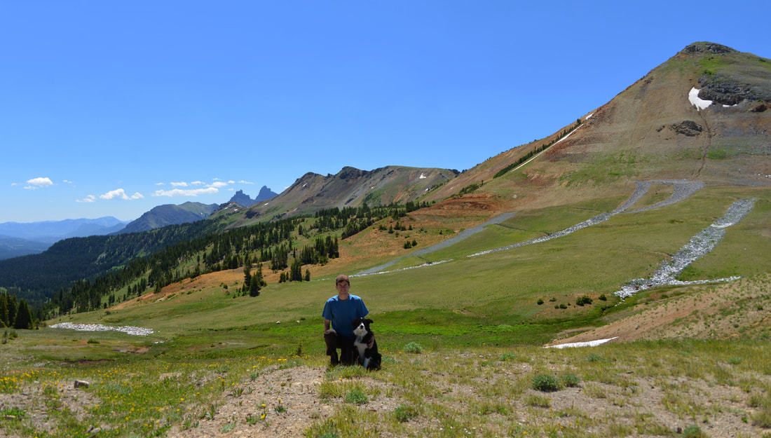
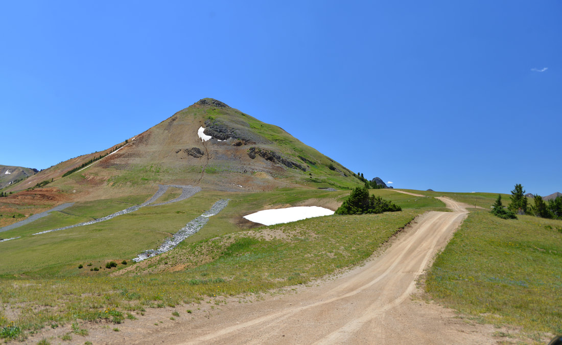
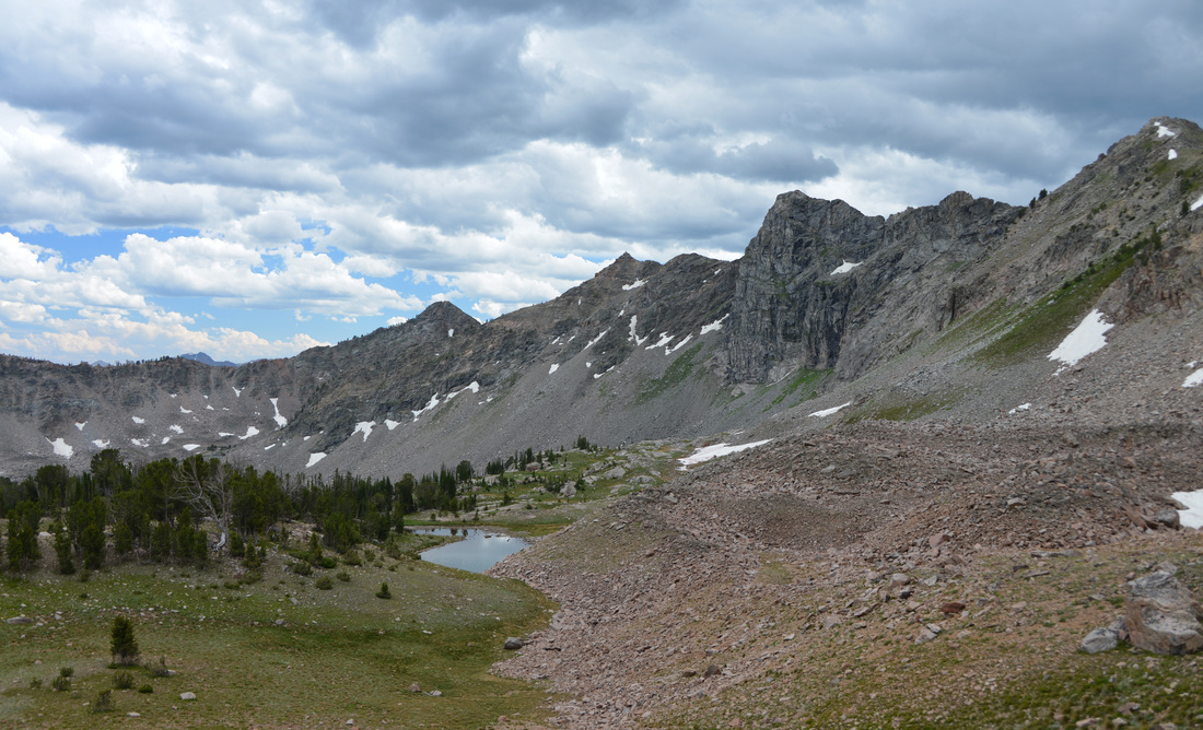
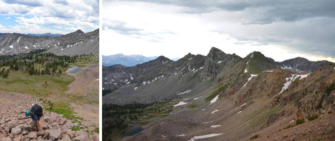
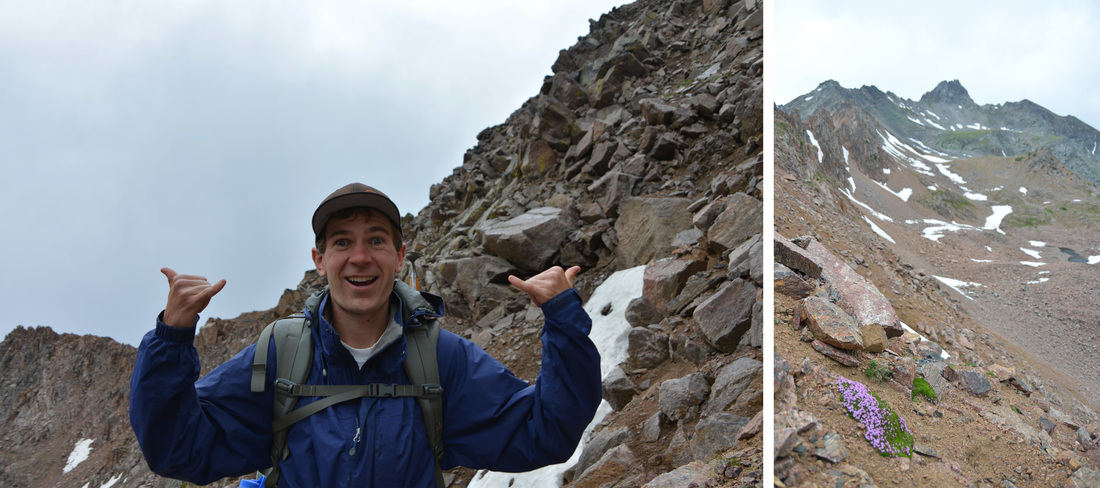
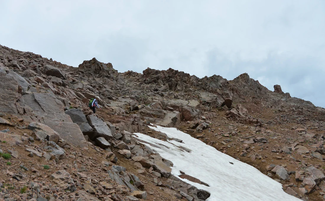
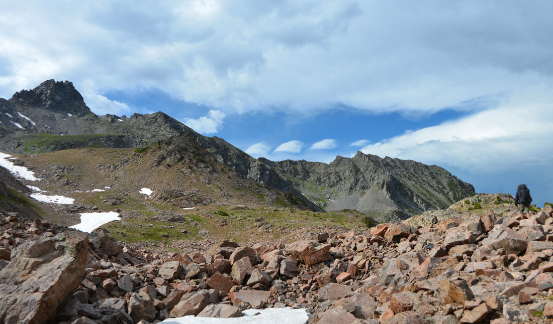
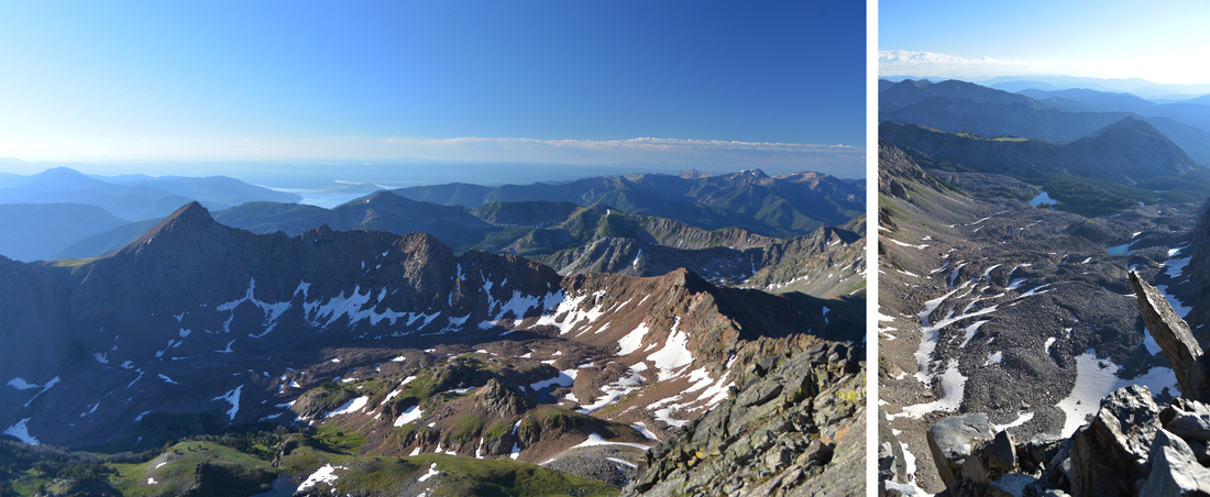
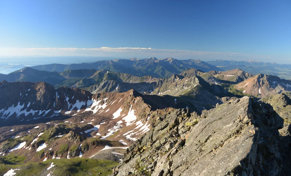
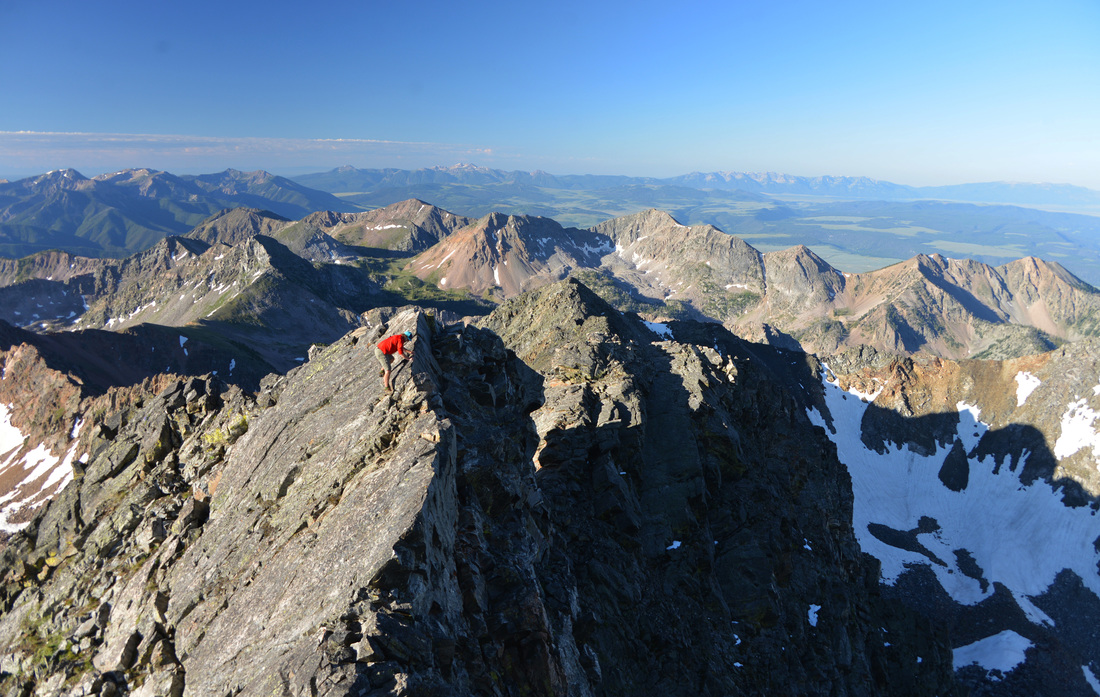
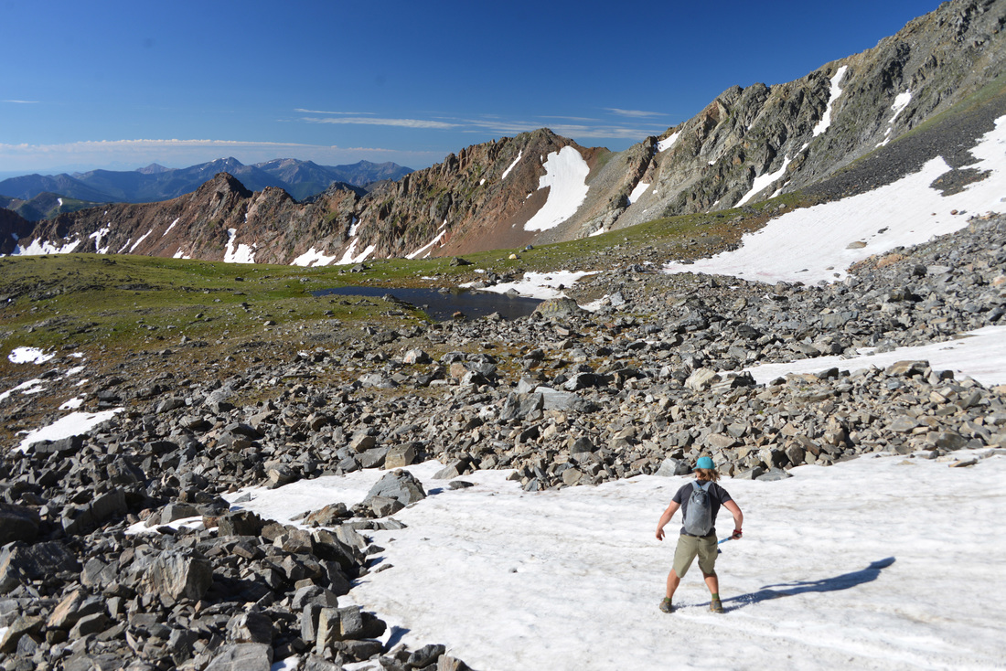
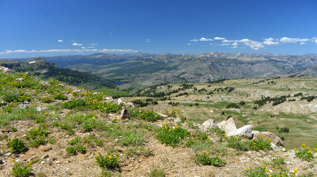
With the remains of our lunches stowed back into the coolers, we set off for a little walk up to the top of Fisher Mountain.  Fisher Mountain tops out at 10,260 ft, but is only a short hike from our lunch spot at the top of Lulu Pass. We clambered up through a steep, lush meadow of alpine wildflowers before reaching a rough 4-wheeler track coming up from the other side of the peak and crested the top of the mountain.  Lex seemed to enjoy the breathtaking views just as much as the rest of us, and we took a few minutes to relax and enjoy the scenery. However, we had more terrain to explore, so we reluctantly left the top of Fisher Mountain, worked our way back to the Raven, and started to work our way around the backside of Fisher Mountain and into the old mine on the south west side of the peak.

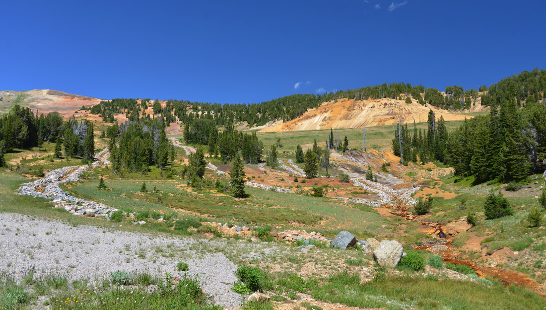
The Daisy Pass area is part of the New World Mining District. Historic activity in this district included gold, silver, lea, zinc, and copper mining.  Several hard rock mines were developed on Henderson Mountain in the late 1870's, but they were not extensively worked until the late 1880's.  Much of the mining activity in the district was centered on Republic Mountain, South of Cooke City, and Miller Mountain, North of Cooke City.  The first recorded discovery in the district was by four prospectors and trappers on upper Soda Butte Creek in 1869.  However, their horses were run off by Indians and their expedition was cut short.  Several mines were discovered and staked in a return expedition in 1874, and claims on both Republic and Miller Mountains were established the following summer.  Steady mining development of the district began in 1882.  The Homestake Claim was filed by Sam Mathers on the slope of Henderson Mountain and by 1887 it had produced enough gold and ore to ship to Salt Lake City for processing.  The Homestake claim proved to be rich and was mined extensively until 1894.  The Montana Mining Company acquired nearly one hundred claims Northeast of Cooke City in the early 1900's including properties on Henderson Mountain and Scotch Bonnet Mountain which lie on either side of Fisher Mountain.  By the winter of 1921, six companies were at work in the district and were producing enough ore to raise the possibility of a railroad to Cooke City.  However, the railroad never materialized, and the mines began to shut down in the mid 1920's.

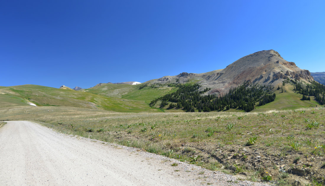
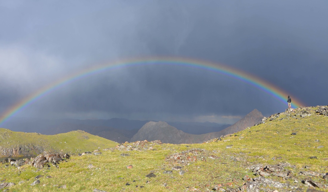
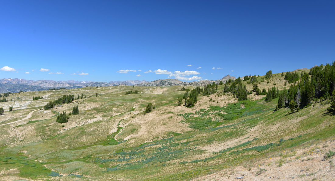
The New World mining district produced 65,000 ounces of gold, approximately 500,000 ounces of silver, and about 4,100 short tons of copper, zinc, and lead between 1900 and 1955. While remote and isolated, the region was the third largest producer of precious metals in Montana in 1926.  In the end, the district was doomed by the lack of and expense of transportation and the harsh winters.  We spent some time wandering a couple of the old mining roads and new trail heads while taking in the mountain scenery.  Scars of the bygone mining era were plainly visible all around us, and we pondered over the history that these mountainsides must have witnessed while we worked our way back to the main road and Daisy Pass.  Upon cresting the summit we parked the truck and explored the pass on foot.  Though it was late into the summer, a snow bank lingered on the east flank of the pass above the truck.  The opportunity was to good to pass up, and Lex, Carl and I were soon found ourselves glissading down the snow field.

BT_50.jpg

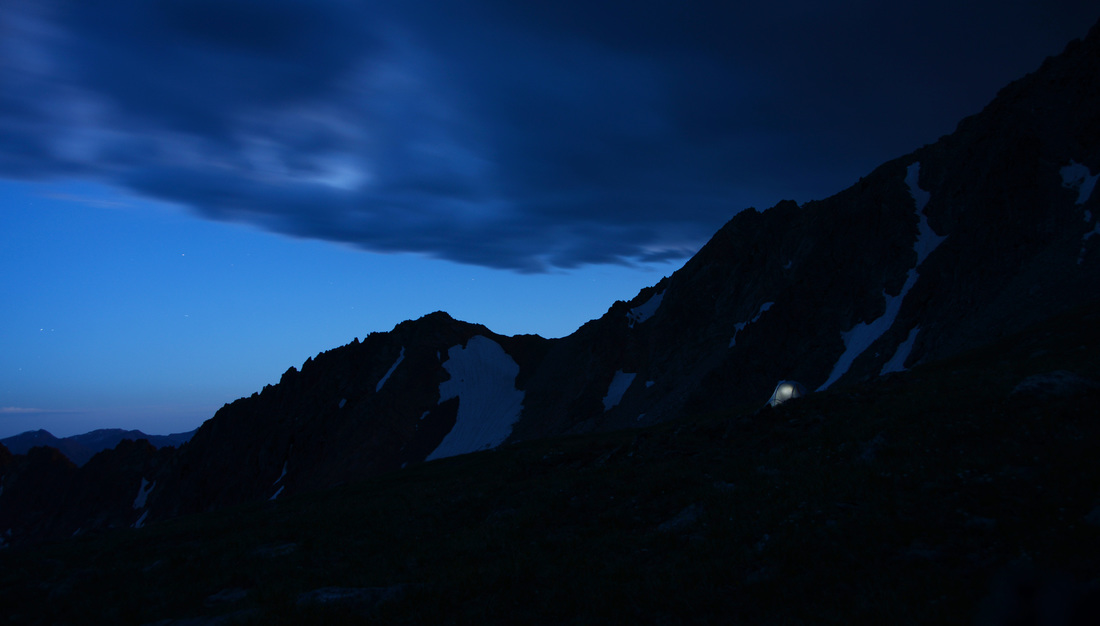
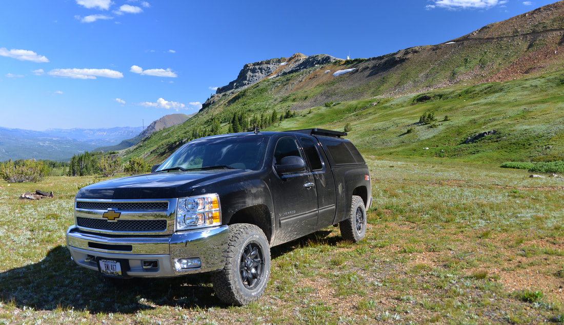
Leaving Daisy Pass in the rear view mirror we started the descent down the South side of the pass back into the valley and Cooke City.  Numerous side roads leading off into the unknown tantalized us, but the day was running short and exploration of these tracks would have to wait till another day.  We stuck to dirt back roads and avoided the highway all the way back to the Lulu pass road and were soon climbing back towards camp.  However, we just couldn't make ourselves call it a day quite yet, so we set off for a little more exploration and turned off on a rough side road climbing up the Southeast side of Henderson Mountain.  The road treated us to more breathtaking views of Pilot and Index peaks as it switchbacked up the side of the mountain.  Knowing the road didn't go much further, we parked the truck in a high meadow below Henderson Mountain and set off on foot up a four wheeler trail that climbed towards the ridge line.  After soaking in the afternoon sun and checking out a rescue gear cash, we worked our way back to the truck and returned to camp.  We soon had the campfire crackling back to life and proceeded to whip up some steak sandwiches and potatoes and peppers cooked in foil over the coals for dinner.  Sunset turned to starlight as we relaxed around the campfire before finally crawling into the sleeping bags to rest up for one more day of adventure.

BT_66.jpg
BT_73.jpg

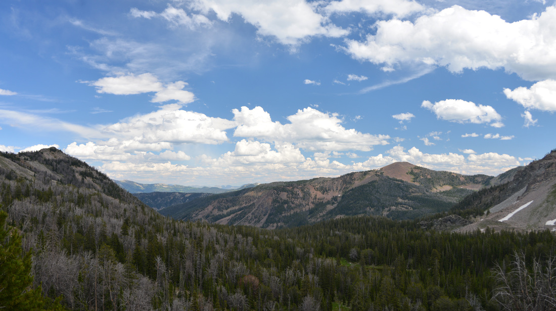
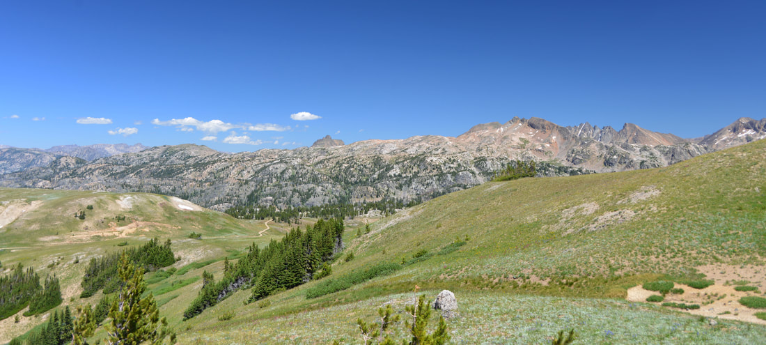
Monday morning dawned crisp and clear, perfect weather to head higher into the mountains towards the top of the Beartooth Pass.  After fueling up for the day with breakfast, we packed up the cars and worked our way back down the Lulu Pass road to the highway were we turned the trucks east.  The highway slowly wound its way through forests, wet meadows, waterfalls, and lakes as it gradually climbed higher into the alpine.  Soon the signs for the Clay Butte fire lookout appeared on the side of the road.  On a whim, we followed their directions and turned off the highway back onto a dirt side road.  Unfortunately it turned out that the road and fire lookout were closed on Mondays, so we parked the truck at the closed gate and set out towards the lookout on foot.

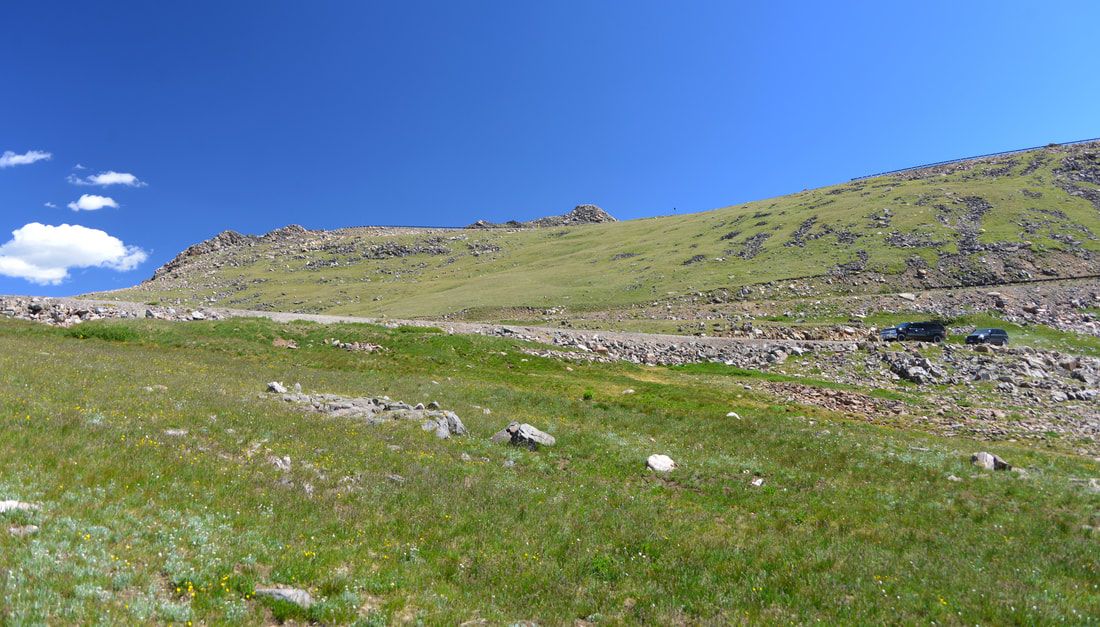
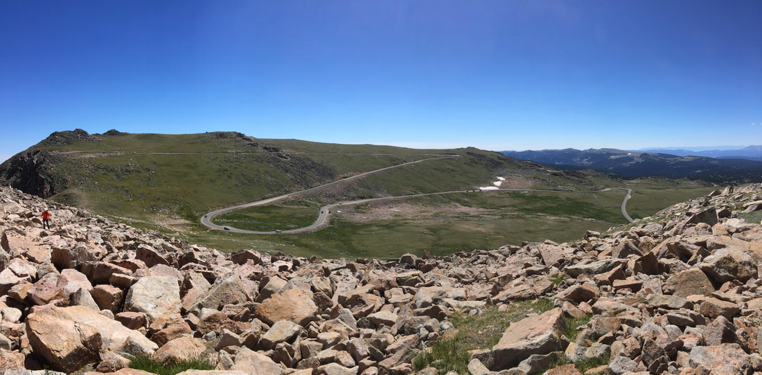
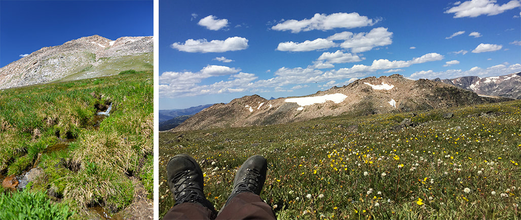
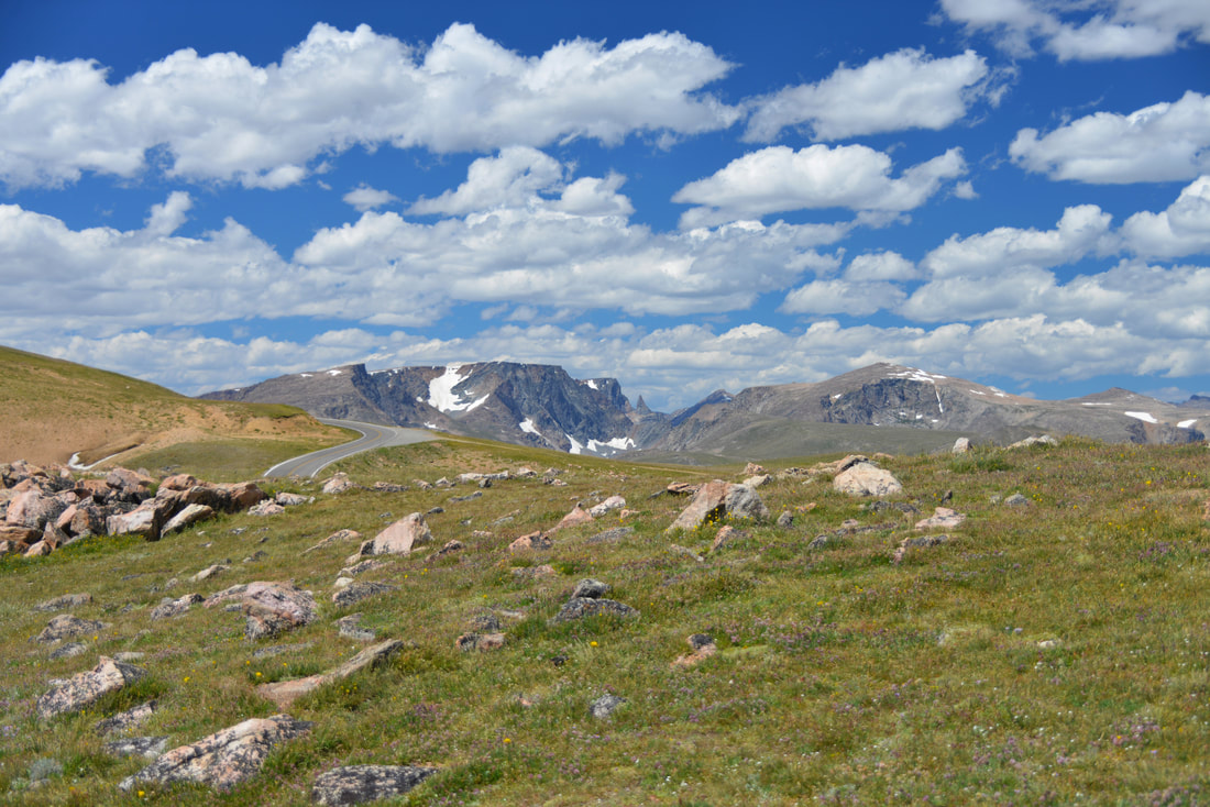
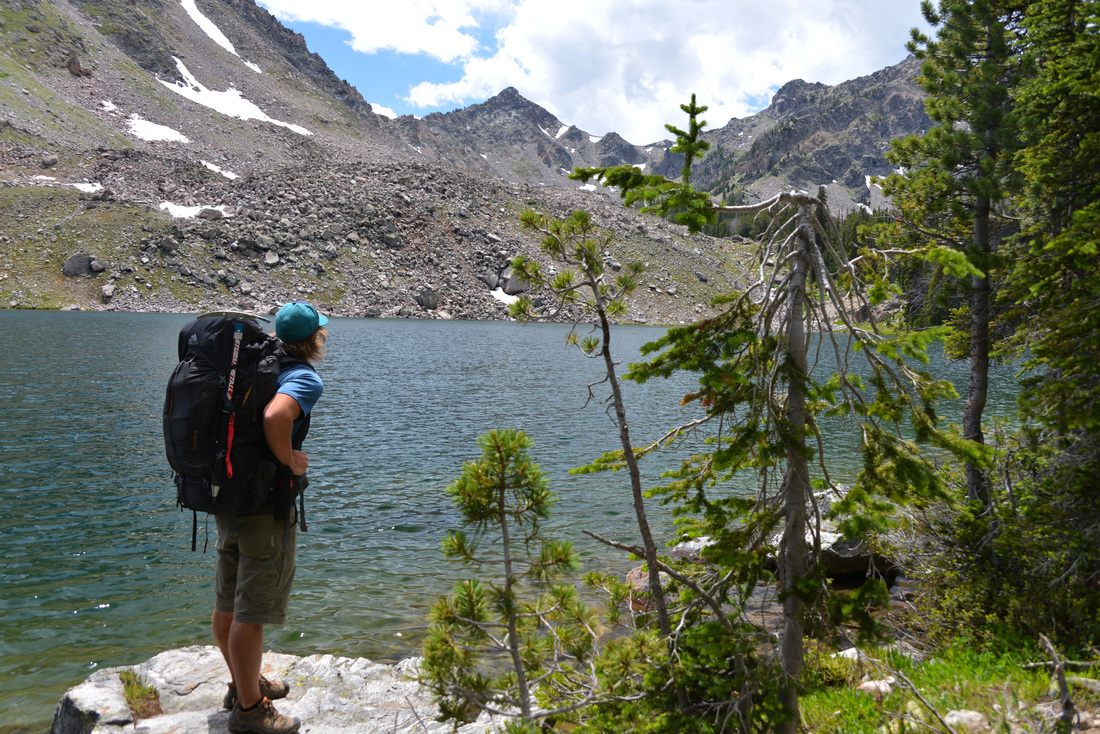
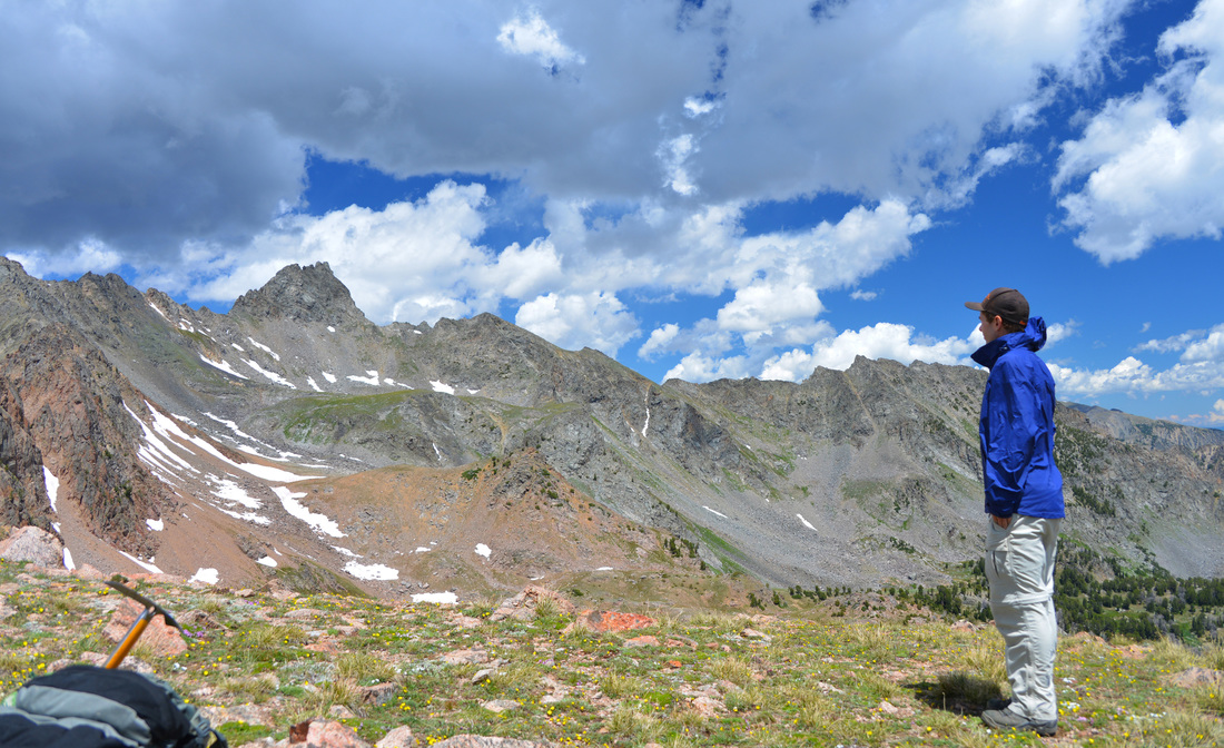
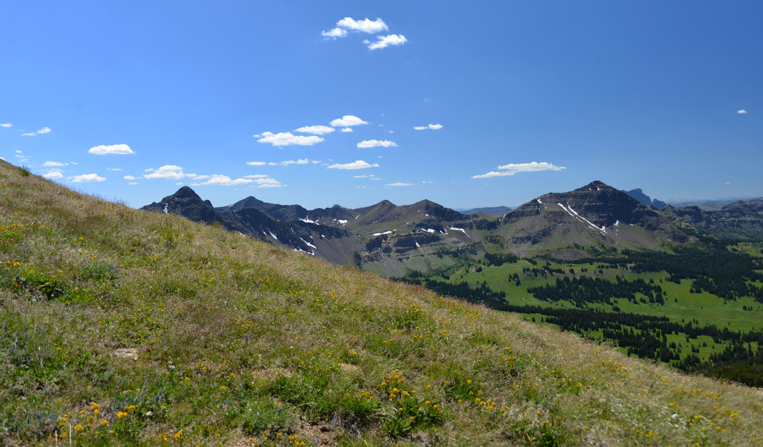
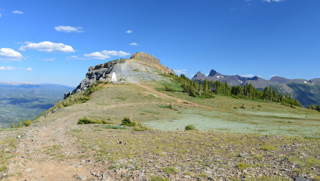
The Clay Butte Lookout was completed by the Forest Service in 1943 and is listed on the National Register of Historic Places.  From its windows the rangers had a stunning 270+ degree view across the valleys of Montana and Wyoming stretching out into the distance.  It is a life that has always intrigued me, and the thought of spending a summer scanning the horizon for signs of fires from your own lookout is always fascinating.  We spent some time taking in the views and as much of the lookout tower as we could access before heading back to the cars and resuming our journey up the highway.  Not long after leaving the lookout we passed Beartooth lake, Top of the World Lodge, Island Lake, and started to work our way into true alpine landscapes.  The switchbacks in the road became tighter and more frequent the higher we climbed, and before long we were nearing the pass.  We stopped in a pullout along one of the upper switchbacks and set off on foot up into the alpine tundra.  More stunning scenery was the reward for our efforts, and we spent some time enjoying the views while Lex played in the snowbanks before heading back to the cars and up to the Beartooth Pass.

The Beartooth Pass parking area was filled with tourists enjoying the views, but we easily found a place to park and a nice soft piece of tundra to relax on over lunch.  We lounged back into the soft hummocks of vegetation as we enjoyed the afternoon sun and our sandwiches.  All too soon it was time to keep moving, so we reluctantly packed up the truck and hit the road again.  Finally reaching Red Lodge, we celebrated the completion of the trip with some refreshing Ice Cream along the Main Street of town before parting ways and heading for home.  It was a great trip filled with amazing scenery, weather, and company.  It was wonderful to explore some of the areas that I have driven by for so many years, and the trip whetted our appetite for further adventure in the Beartooths!

BT_98.jpg

Return to Beaver Creek - Hilgard Peak

The small parking area that we pulled into late morning on a sunny, July Friday held little resemblance to the snowy field that we had traversed less than a year ago.  A few months ago Carl, Ashley, and I had traveled this same path up Beaver Creek in the depths of winter, our tracks covered by softly falling snow and the darkness of night as we battled sickness and exhaustion on the trek to the cabin.  Now, however, this parking lot no more than a quarter of a mile from the cabin was only the starting point.  This time, our destination was the top of Hilgard Peak.

The 11,316 foot summit of Hilgard Peak is the highest point in the Madison Range and the highest peak in Montana outside of the towering Beartooth Mountains.  The rocky summit is remote and requires a 5-6 mile approach by trail to Avalanche Lake followed by an off-trail journey over a sharp saddle and across a rocky basin to the foot of the mountain.  Traffic in this remote part of the Lee Metcalf Wilderness is light, and you are more likely to see a grizzly bear or mountain goat traversing the hillsides than another climber.  I had been eyeing the peak for a year, so when Austin inquired as to my interest in joining him on a mission to climb the peak, the answer was a no-brainer.  Ashley had some misgivings about the nature of the climb, but a little encouragement soon had her on board.  Unfortunately Carl had to work and the climb didn't sound friendly to the four legged friends, so the party that set out from the truck consisted of Austin, Ashley and I.

Right out of the trail head we dropped down several switchbacks (disappointing, considering we knew we just had to gain the elevation back) to cross the main fork of Beaver Creek.  The first few miles of trail took us along a gently climbing contour above the west fork of Beaver Creek, traversing steep, eroded hillsides and washed out gullies.  A sign at the trail head warned of bad trail conditions due to washouts, and we soon were introduced to these obstacles.  Several side gullies into the main creek have experienced significant erosion in the last couple years, and the old trail is completely destroyed in several locations.  Fortunately, these washouts only briefly slowed our pace and before long we found ourselves on gentler slopes with the creek closing the distance on our left.  A spectacular cascade perfectly placed for optimal viewing from the trail and a lunch break when we got to the creek crossing delayed us a little, but mid afternoon found us climbing onto the shores of Avalanche lake.  We dropped our packs at a campsite by the lake shore, skipped a few rocks (or at least attempted to find rocks of the correct shape to skip), and rested up for the climb over the ridge to our campsite below Hilgard Peak.

BC_1.jpg
BC_2.jpg
BC_5.jpg
BC_8.jpg
BC_9.jpg
BC_11.jpg

We would have loved to linger at the lake shore in relaxation, but the mosquitoes were providing motivation to get moving, and we still had the hardest part of the day ahead.  We worked our way deeper into the basin around the west shore of the lake, eventually wrapping back to the north around some marshy pot hole lakes towards the grassy slope we had identified as the easiest climb to the ridge line.  The first part of the climb consisted of a set of small but steep slopes into the upper basin directly below our targeted saddle.  Unfortunately, this part of the climb also consisted of ravenous clouds of mosquitoes.  The marshy pot hole lakes we had been walking by were perfect breeding grounds and the clouds of blood suckers following us seemed to grow by the second.  The air was mercilessly still and heavy, and the swarms of mosquitoes descended on us like a plague as we climbed through the boulders.  Ashley's hat was speckled with the villains any time we stopped, and seemingly the only way to keep free of the pests was to keep every part of the body moving at all times.  Any onlookers probably would have thought us possessed, but the flailing kept most of our blood inside our bodies, and we finally reached the base of the ridge line, anxious to get up into the alpine where the weather is less friendly to insects of the blood sucking variety.

The climb to the crest of the ridge was steep, but the farther we got the more mosquitoes were left in our wake.  The weather was also beginning to play more into our favor, with the clouds slowly turning a shade of grey and a cool breeze picking up as we gained elevation.  Upon reaching the crest of the ridge we were greeted by low rumblings of thunder, a few sprinkles of rain, and our first views of Hilgard Peak.  The basin stretched out below us was every bit as spectacular as I had imagined, and the jagged top of the peak looming at the upper end of the rocky valley was even more imposing than I had been expecting.  The descent into the basin was a steep and loose affair; with no trail to follow we picked and slipped our way through the loose rock and dirt.  Our heavy packs provided a little added complication, but we were soon setting foot on the boulder fields at the bottom of the slope and hopping our way towards the mountain. 

As we neared the final bench below the summit that was to be our camp for the night, the heaviest rain squall of the day set in.  Cresting the final rim I dropped my pack, turned to the east, and was greeted by one of the most spectacular rainbows I have ever seen.  The combination of rain over us and sun behind us with the illuminated alpine tundra, dark clouds, and the striking rainbow made for a special sight.  When Austin and Ashley joined me moments later we were like kids in a candy store, awestruck by the show.  Eventually the rainbow faded, the sun came out, and we set to work getting camp in shape, replenishing our water supply, and getting dinner cooking.  We dined on backpacking pizzas in the shadow of Hilgard Peak before turning in for the night, tired after a long days hike and eager for the summit attempt early the coming morning.

BC_19.jpg
BC_21.jpg
BC_23.jpg
BC_31.jpg
BC_36.jpg
BC_37.jpg

We rose with the sun around 5:00 in the morning, grabbed a quick breakfast, lightened our packs, and started off towards the peak.  The first stage consisted of a steep but stable climb from camp up to the east ridge of the summit where the real fun began.  I had been expecting a little scrambling to get to the top, but the terrain we found ourselves facing was much more technical and exposed than I had anticipated.  From the ridge, the obvious route was up the gaping mouth of the steep, narrow chute in front of us.  Crisscrossing from side to side in an effort to stay on solid rock, we made our way up the chute to what turned out to be the crux of the climb.  What would have been an easy climb under other circumstances was complicated by handfuls of loose dirt on every possible hand or foot hold, and our larger than desirable packs (Austin happened to have a little pack stashed in his big bag which made things much easier, but Ashley and I had our backpacking packs to contend with).  Austin and I made it through the exposed section, but Ashley had gotten stuck on what had appeared to be an easier line that didn't pan out as planned.  After making it back down into the chute with acrophobia kicking in from the exposed climbing, she made the hard decision to stay there and wait for Austin and I to summit.

With the group split up, Ashley got comfortable to enjoy the early morning while Austin and I continued up the final few hundred yards to the summit.  The remaining portion of the climb proved to be much easier, with solid rock, grass, and multiple line choices to make things interesting.  The last pitch to the summit was completed a few minutes after 7:00 and we dropped our packs to revel in the views and the serenity of the early morning.  The top of the peak is just as striking as the views from below would suggest, with breathtaking scenery in every direction and equally breathtaking drops on all sides.  The East and North sides of the peak are particularly steep, dropping thousands of feet vertically in near shear cliffs to the valleys below.  Austin and I spent around a half hour taking in the views and enjoying the rewards of our climb before starting the descent to the valley below.

BC_38.jpg
BC_54.jpg

After finding a slightly easier route to avoid the chute that had been slightly problematic on the way up, we rejoined Ashley who had been enjoying good views of her own and returned to the saddle above camp.  The scramble back to our tents was dispatched quickly and by 9:00 we were taking our boots off and getting the stove going for celebratory hot beverages.  A little relaxation and exploration of the bench we were camped on filled the next couple hours before it was time to break camp and start the trek back to the truck.  The hike back out of the basin was uneventful save for the steep climb back to the saddle above Avalanche Lake.  We took turns scrambling and crawling up the steep, loose, dirt to avoid sending debris down on the others and eventually topped out on the saddle.  After visiting with a hiker attempting the peak in one day, we bundled up more than the weather dictated to protect us from the coming hoards of mosquitoes and headed down towards the lake.

The gauntlet of mosquitoes was run with minimal losses and the hike out from Avalanche Lake was dispatched with easily.  Before long the last few switchbacks up to the parking lot were conquered, packs were dropped, and we were breaking open chips, salsa, and beers while relaxing on the tailgate reminiscing over the adventure.  It was a trip to remember and a good break from the stress of the last few months.  Although short in duration, the memories from the expedition will be ones I will treasure for ever.  Few trips of only two days have had so many postcard worthy moments, and sharing the experience with good friends never gets old.  Hilgard was arguably the best trip of the summer, and it will be a hard one to top!

BC_56.jpg
BC_67.jpg

Ghouls, Colds, & Cabins

The possibility of collapsing into a snowdrift along the side of the path was very real, although it was pitch black and I couldn't really tell if it would be a snowdrift, a ditch, or a creek that my body might fall in.  I hoped if the worst did occur, the others in my group would notice that they were one member short and at least provide a proper burial.  I had been struck with a cold the night before, and a three and a half mile snowshoe into our cabin was being complicated by exhaustion, throaty hacking, and more gear than would probably be necessary for the next two days.  Pondering the options of who might recover my body, I popped in a new cough drop, put away the headlamp that had just died right when it was needed, and resumed dragging my leaden feet up the trail.

Other than the sickly shell of my usual self, our group consisted of my good friends Carl, Ashley, and of course my trusty four-legged outdoor companion Lex.  We had left the truck parked at the Refuge Point parking area near Hebgen Lake at 5:00 that evening.  Plans to leave earlier had succumb to the realities of real life commitments, packing, loading the sled, and making it to the trail head.  The drive down the canyon had been a snowy one, and snowflakes continued to build up on our coats at a surprisingly fast pace.  Darkness had long since set in, and our figures were silhouetted by snowflakes and a halo of golden light from Carl's headlamp as we worked our way into the mountains.  Carl managed to break the sled I had rigged up to carry our gear in four times before we finally replaced the zip-ties with para-chord, and mercifully were allowed to continue our trudge ever closer to shelter.

I don't know what time we finally reached the cabin, the act of looking at my watch never occurred to my tired and sick brain, but it was sometime after 8:00 when we finally got the fire going in the wood stove and set about getting our dinner ready.  Steaks were put on the fire, potatoes were prepared, and I got out my backpacking stove to boil some water for a round of well deserved hot chocolate.  Unfortunately, my backpacking stove had other ideas.  After years of flawless use in the mountains and canyons of the West, the stove decided that this was a perfect time to take a break, and refused to start without spewing gas across the table.  We resigned ourselves to our fate, and proceeded to do our cooking solely on the single burner of the cabin's wood heating stove while entertaining ourselves with entries from the cabin's guest book.  The story of Turd Ferguson, a turn of of the century mountain man who went crazy at the cabin, had been invented by some creative (or drunk) guest in years past and his ghost had become a common fixture in many of the entries.

Dinner was finally ready around 11:30, and we scarfed down delicious elk steaks and potatoes before washing it all down with some hot chocolate.  Tired from our afternoon exertion (and my cold), we quickly got ready for bed and crawled in our sleeping bags.  We woke up the next morning to clearing skies and fresh snow hanging in the trees.  The storm had subsided sometime during the night (no earlier than around 3AM though, which I know because that was when I got up to pick up the wrappings of our steaks that Lex had found in the trash and shredded across the cabin floor...) and we were greeted by the sun playing across the slopes of the surrounding mountains.  My cold had subsided some, and we took the opportunity to get our first good look at the cabin and its surroundings, even discovering a quinzee snow shelter in the back yard.  Coffee was promptly prepared and pancakes were soon cooking in the skillet.

BCT_1.jpg
BCT_2.jpg
BCT_3.jpg
BCT_5.jpg
BCT_6.jpg
BCT_7.jpg
BCT_8.jpg

After eating our fill of pancakes we set about completing some tasks around the cabin.  Dishes were cleaned, wood was split, the outhouse entrance was shoveled out, and water was boiled for the rest of the day.  By mid afternoon we were finally ready to do a little exploring, so we donned our snowshoes and set out farther up the road.  A leisurely mile long snowshoe hike brought us to the end of the summer road and the meadow known as Potamogeton Park.  A sign proclaimed that the area was named after an aquatic plant that grows in marshy areas, leaving us wondering what exactly a potamogeton is, and, assuming the pronunciation was "pota-mog-eton," if the name was as Native American as it sounded.  Later we found out that the word is actually the scientific name for pondweed, has it's origins in Greek, and is pronounced "potamo-GEE-ton."  Yeah, we're three scientists...  Oops...  We did agree, however, that Pondweed Park just wouldn't have quite the same ring to it as Potamogeton Park.

Not quite ready to head back to the cabin yet, we decided the Sentinel Creek trail could use a little exploring, and took off down the trail following the remnants of an old ski track.  We followed the trail for half a mile or so, crossing a creek and a couple hills, all of which were burried in a deep blanket of fluffy powder.  After a quick photo opp, we turned around and started the trek back to the cabin.  The hike back to warmth and shelter had been quite uneventful when, around a half mile from the cabin, Lex suddenly stopped in the middle of the road.  I could tell he was intently focused on something right ahead of us, and pretty quickly realized it was more than just a person, dog, or even a deer.  Lex inched his way up the road, and we followed cautiously, wondering just how worried we should be.  He then proceeded to increase our uneasiness by suddenly turning tail and running around behind us before cautiously trotting back to the front of the line.  After repeating this several more times and thoroughly creeping us out, he finally dashed ahead past whatever was lurking in the forest and waited for us to catch up.  What sort of beast was hiding out in the recesses of Beaver Creek will never be known.  Maybe it was a mountain lion, a wolverine, or maybe we had run into the mythical ghost of Turd Ferguson chronicled in the cabin logs.  Whatever the case, the last steps to the cabin passed uneventfully, and we soon found ourselves stoking up the fire, getting out of our snowy gear, and putting on the water for hot chocolate.

BCT_9.jpg
BCT_10.jpg
BCT_11.jpg
BCT_12.jpg
BCT_13.jpg
BCT_14.jpg
BCT_15.jpg
BCT_16.jpg
BCT_17.jpg
BCT_18.jpg
BCT_19.jpg
BCT20.jpg

Upon arrival at the cabin, Lex promptly claimed a comfortable spot on my sleeping bag, where he stayed most of the night until I kicked him off long enough to allow me to claim my spot inside the bag.  The rest of us set about with dinner and soon had a couple leftover steaks, pasta, and bratwurst sizzling on the wood stove.  Dinner consisted of pasta topped with Hawaiian bratwurst, peppers, onions and cheese finished off with a couple of elk steaks.  Mountains of food quickly formed on our plates despite Ashley accidentally donating a substantial portion of pasta to Lex via the floor (that's what happens when all of the pasta decides to evacuate the container at the same time...).  Stuffed with good food, we sat back to enjoy a relaxing night in the cabin and sip our final cups of hot chocolate.  Sleep soon began to knock on the door, and we easily succumbed to the comfort of our beds and a well deserved nights sleep.

BCT_21.jpg
BCT_22.jpg
BCT_23.jpg
BCT_24.jpg
BCT_25.jpg

Our final morning at the cabin dawned cold and unsettled.  A wind had picked up sometime in the wee hours of the morning and the trees swayed back and forth in rhythm with the gusts as pillows of fresh snow dropped from their resting places and sifted down through the boughs.  Water was boiled for morning coffee and we soon found ourselves munching on cinnamon rolls baked in tin foil on the stove.  A round of bacon was prepared to give us the needed strength for the hike out to the truck.  The rest of the morning was spent getting the cabin ready for the next group and attempting to fit everything we had brought back into our packs and the sled.  After splitting firewood, cleaning dishes and the cabin, and somehow conquering the Rubik's cube our packs had transformed into, it was time to say good bye to Beaver Creek Cabin and head back to civilization.

Sad to be leaving the perfection of the Yellowstone backcountry for the tedium of real life, we clipped into our snowshoes, hoisted our packs, and set off back down the road.  The hike out to the highway was uneventful and relatively painless, and we were blessed with stunning views of the mountains that had been obscured by darkness on our way into the cabin.  A brief but serious heart attack was had when I thought I had lost the keys to the truck, but I soon found them in my gloves (apparently I had taken them out of my pocket and put them with my gloves when I took them off, none of which I remembered at the time) and we loaded all of our gear and set off for Bozeman.  After a beautiful drive through Yellowstone and Big Sky we stopped at the Coffee Pot for a desperately needed cup of coffee and slab of pie, and then it was back to our homes and couches.

Despite my cold, which came in for a second round upon my return home, the trip was a success for all.  Beaver Creek Cabin is a wonderful gem, and is only surpassed by the beauty and magnitude of the mountains in which it sits.  We left awed by the area, and hope to return in the near future.  Who knows, with the way this year is going, maybe it will be tomorrow...

BCT_26.jpg
BCT_27.jpg
BCT_28.jpg
BCT_29.jpg
BCT_33.jpg